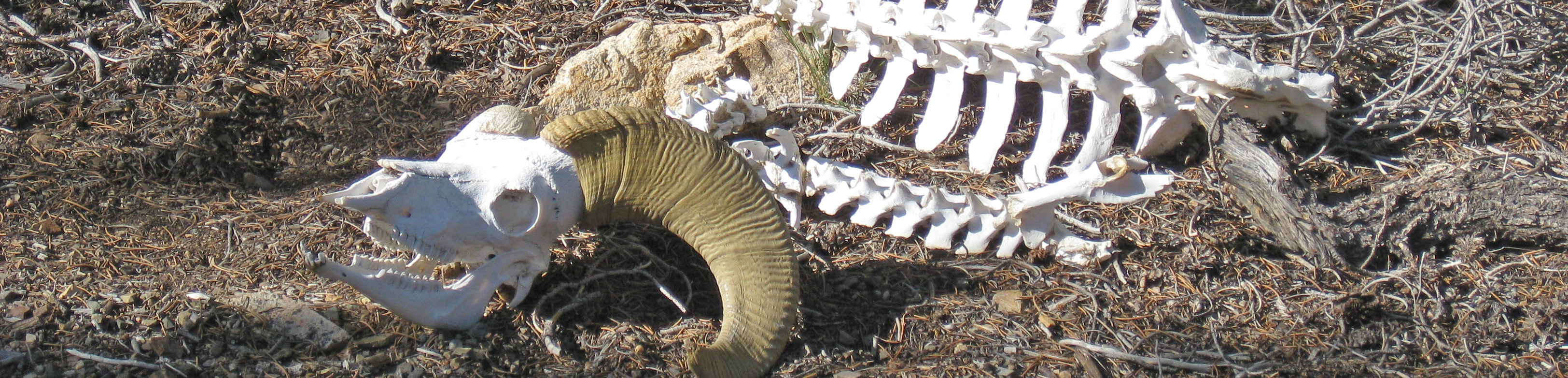
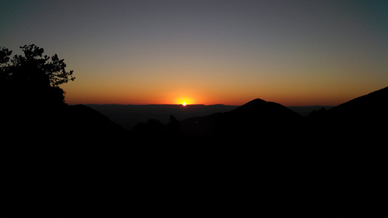
We awoke at 6am to a clear, windless 45° morning. A little chilly, but the sun soon warmed us. As usual on our first morning, we had lox and bagels for breakfast. While we sat eating, a couple dozen very fast birds, I think swifts, flew right through our campsite. They came out of the valley to our west and went down the canyon to our east, flying low to the ground practically in front of our faces. I was thinking they must flly over this pass every morning, and that they just weren’t used to people being in their way. We also saw some huge wasps, which Greg thought were the same type as the one that landed on his shoulder and scared him to death in Utah last year. If so, these might be cicada killers, harmless to people.
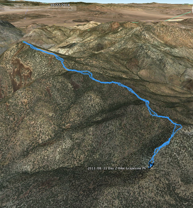
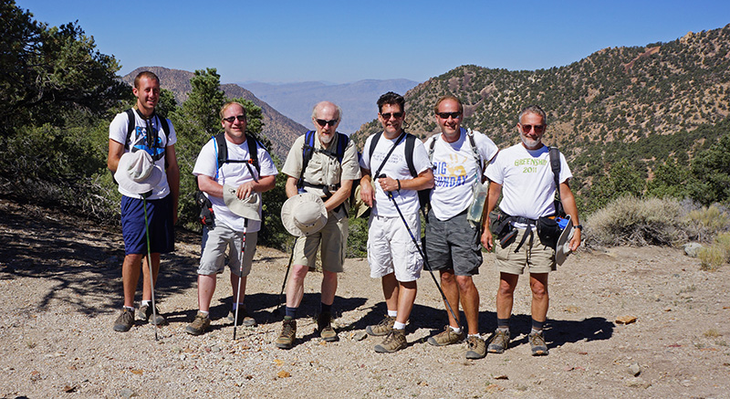
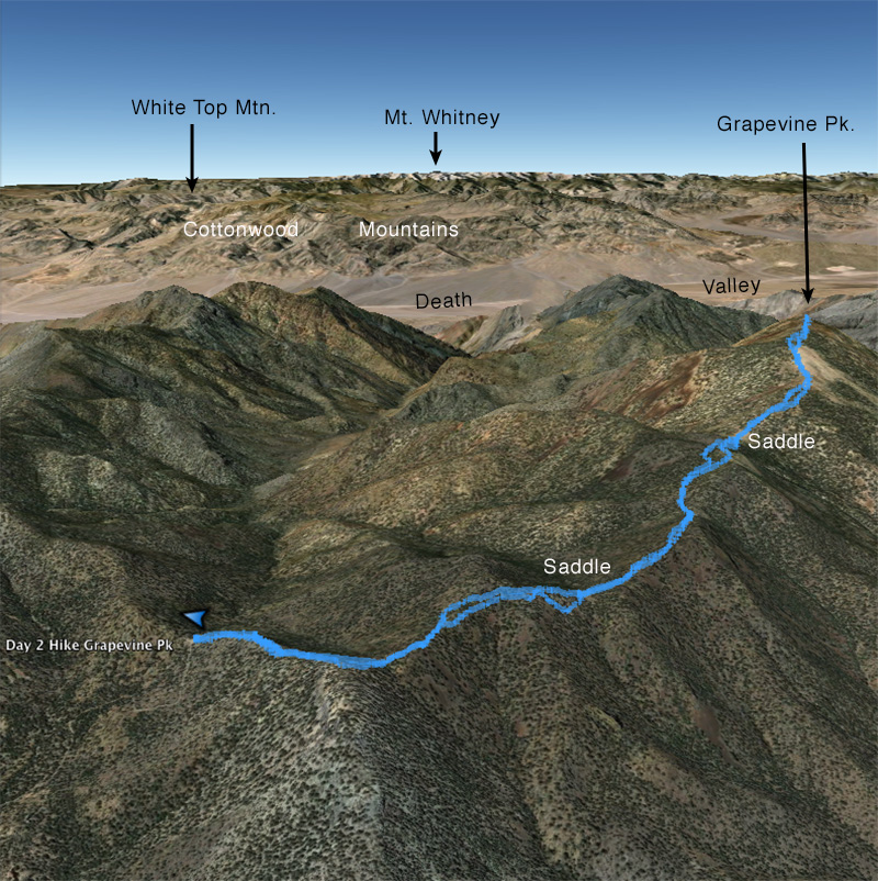
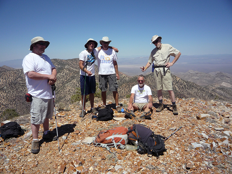
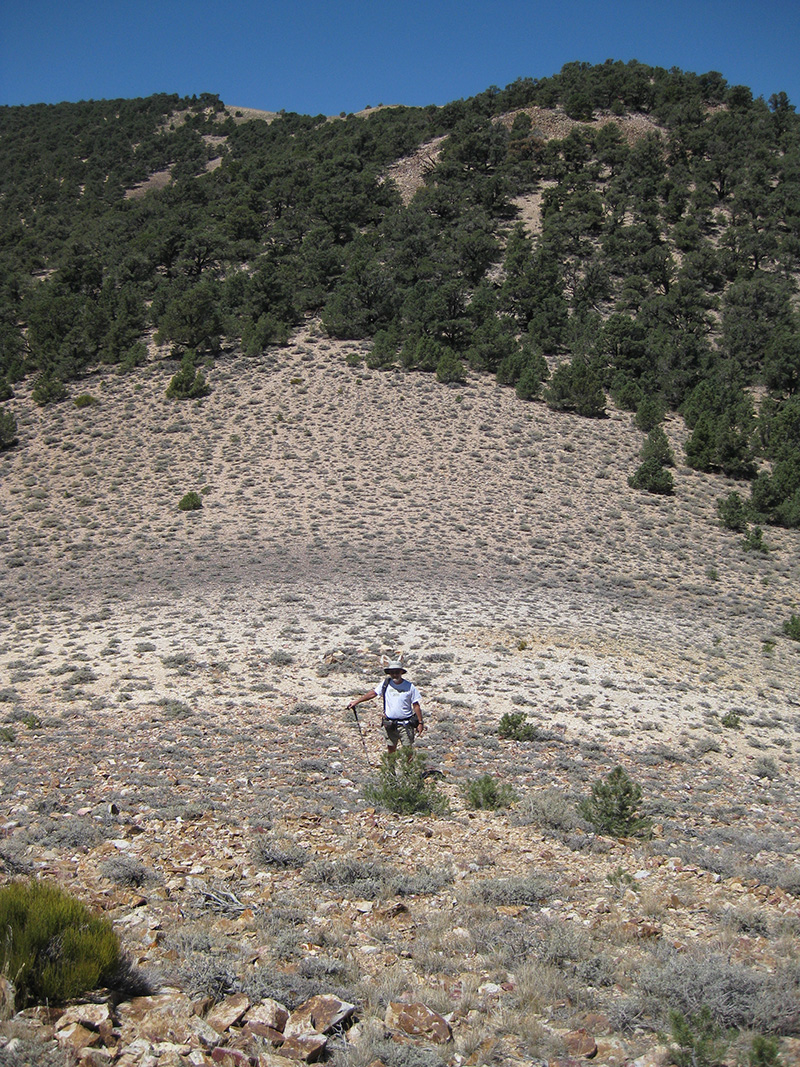
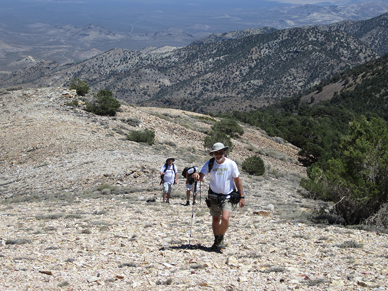
Today’s plan was to do the longest hike of our trip, Grapevine Peak. We were ready to hike at 10:10am after posing for a group photo. Like most hikes in Death Valley, there was no designated trail, but we found multiple paths where people have walked before. The first part of the hike, ascending the ridge, was steep and rough, but then it leveled off with easier walking most of the rest of the way. I knew from the map there would be lots of ups and downs, but there were even more than I expected. Despite Greg’s protestations that we should just stay on the ridge, I tried to minimize wasted ascents by skirting around some of the little summits, but this usually meant more difficult walking on the sides of slopes. This is when it helps to have your right foot shorter than your left.
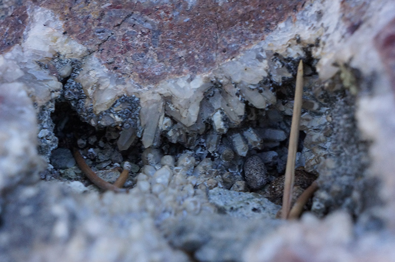
Along the way in the undulating ridge there were two major saddles, even broader and flaatter than the one we were camped in. The route was much more confusing than I expected, because it was not just a simple ridge. During most of the hike you could not see the destination, and there were numerous small summits where we had to decide whether to go left, right or over. While the terrain was not particularly difficult, it had the tendency to dump needles into my shoes, and I had to stop repeatedly to get them out. Of course the views were outstanding in both directions. Closer to us were a series of colorful crystalline pockets, almost geode-like, but embedded in bedrock, and plenty of ancient ghostly dead trees
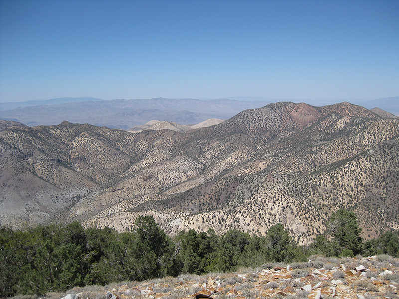
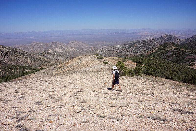
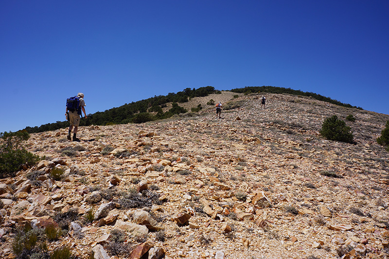
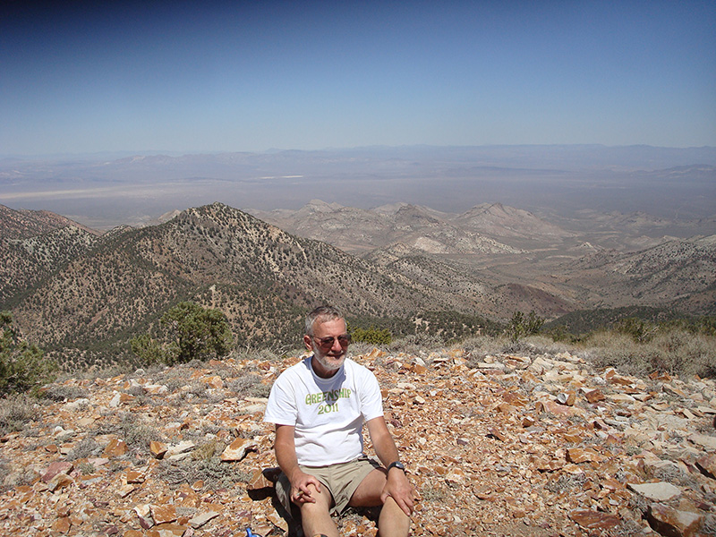
About 2½ hours after starting, we reached the big saddle before the final 800' ascent on the nearly barren “cone” of the summit. It was nice to be out in the open with views in all directions, with not even a pinyon pine to block our view, and at this elevation it was not very hot despite the bright sun. The footing was also pretty good, slightly rocky but solid and not unreasonably steep. But it was still very slow going for some of us who were not in good shape. Plodding along, we reached the summit at 1:50pm, after 2.9 miles and 3.5 hours of hiking. The net elevation gain from the campsite was only 1240', but with all the ups and downs we had 1690' of ascent.
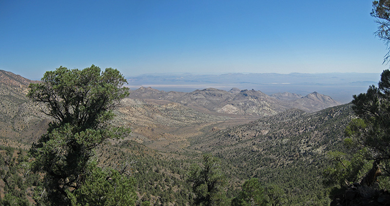
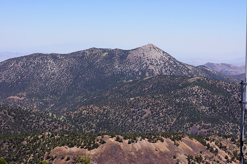
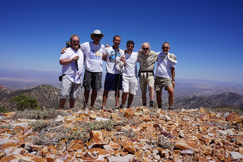
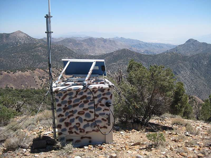
Near the summit we saw our first man-made object, a pole antenna attached to a small camo-painted structure with a solar cell on top. I later found out this was a park service radio repeater used for wilderness management. From the summit the view was of course panoramic. We could see the whole complex ridge of the Grapevine Mountains. Wahguyhe peak was obvious, slightly lower and 3.5 miles away as the crow files. Death Valley was to one side with the Sierra Nevada Range on the horizon, and the Amargosa Desert was on the other side. There were distant mountains in Nevada that we couldn’t identify, as we had no maps that went that far out. As with many Death Valley summits, there was an unofficial box with a register, where we logged ourselves in.
We spent almost an hour on top having snacks, taking pictures and smoking cigars. The weather was perfect, and in fact this entire day was to be absolutely cloudless.
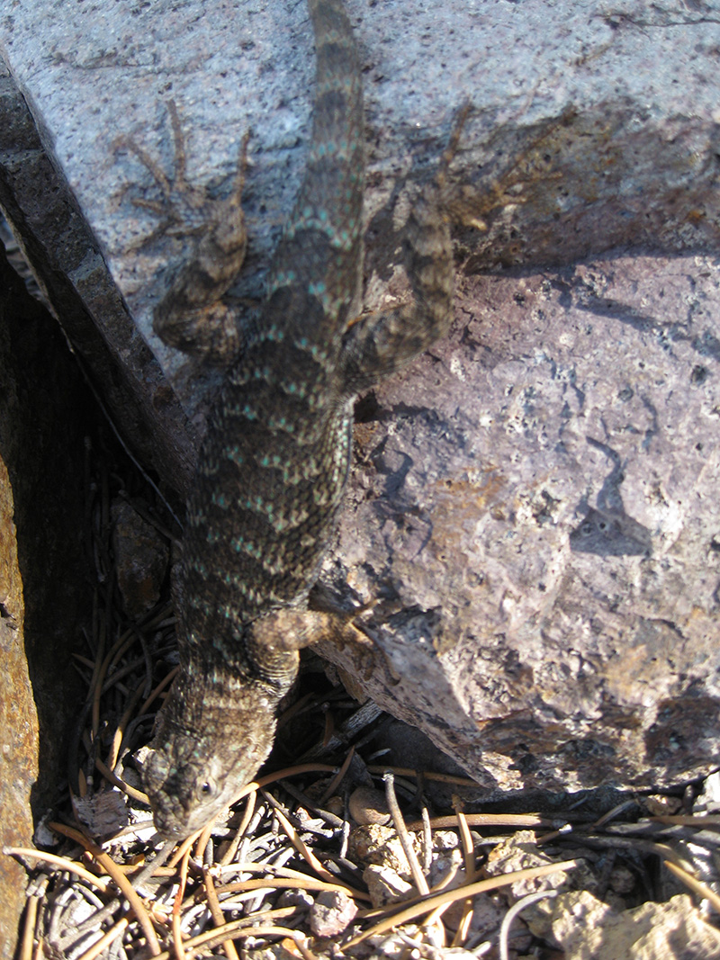
The hike back, while it seemed awfully long, went smoothly. Of course it wasn’t all downhill, as it included 400' ascending. However we chose to stay on top of the ridge rather than try to skirt the numerous rises, and this did make for easier walking. At one point we saw a large fat lizard with stripes on its back that contained blue-green spots, which I haven’t been able to identify. The hike down took an hour less than the hike up.
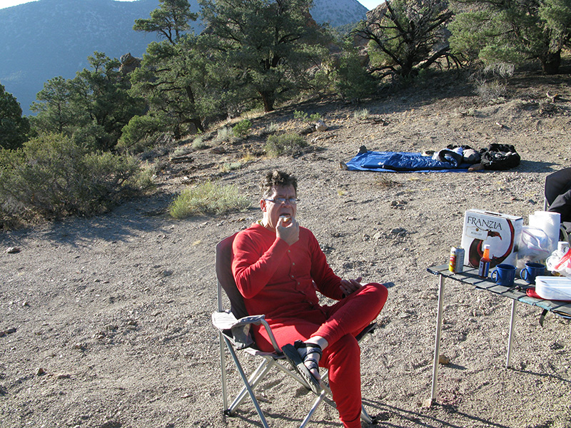
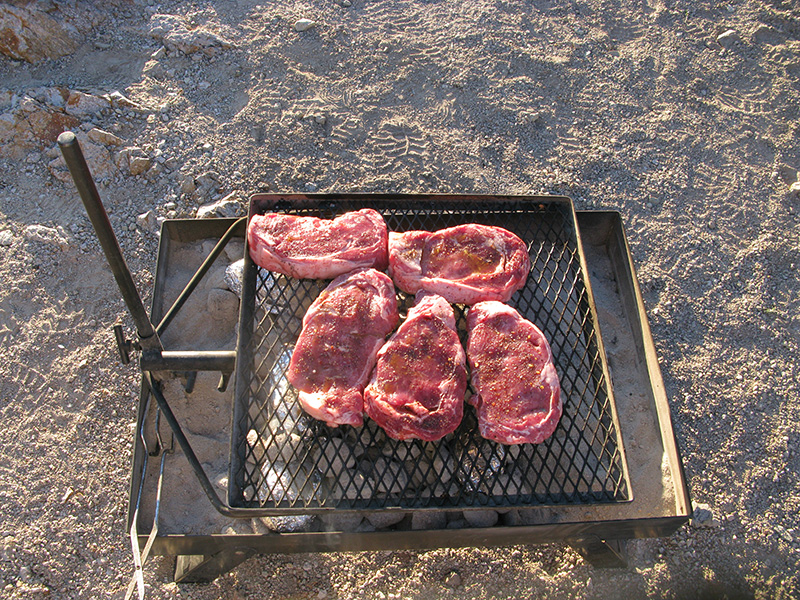
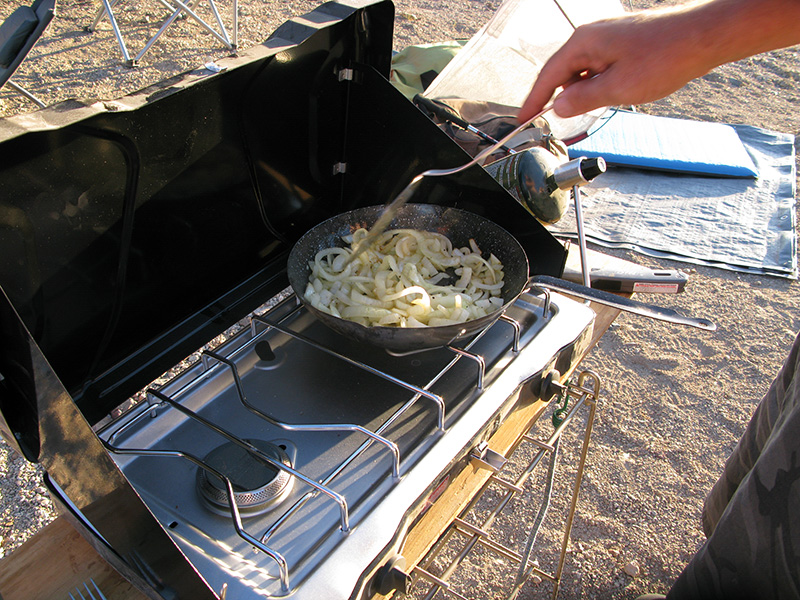
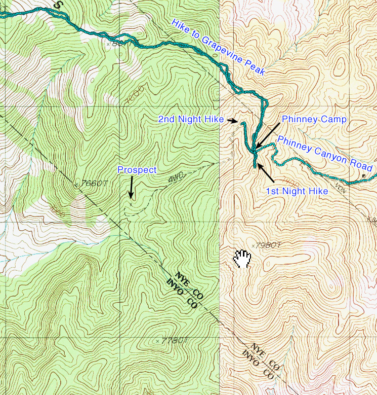
We reached camp just before 5pm, same as the day before, right on time for evening festivities (and work). Steak and onions was our dinner, using the last of our charcoal. When it got dark we played some lighted Frisbee, though there wasn’t that much room to throw it without hitting things in the campsite. For an evening hike we decided to walk down the closed road beyond the wilderness sign. Old topo maps showed it continuing for about a mile, ending at a prospect 600' below, at the 6900' level. But it was almost 9pm, so we only had time for a 25-minute ½-mile round trip hike which did not take us very far down the road.