|
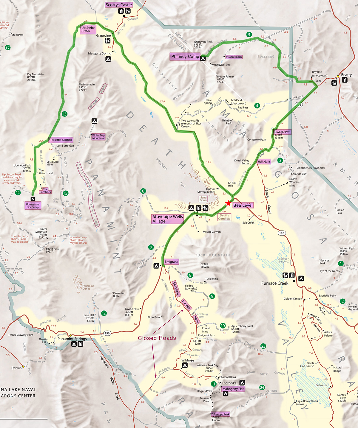
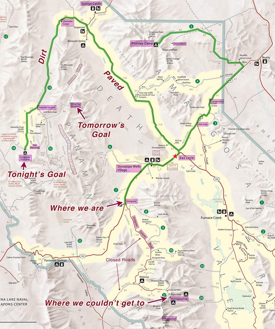
T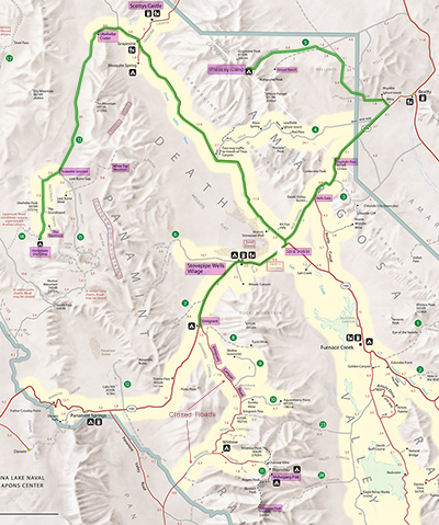 he first of us awoke at 6am as usual. It was 54°, even warmer than yesterday. Today we had to take down camp and head out. But despite all the packing up, we were ready to drive at 9:40am, even earlier than yesterday. Today’s desire was to go to Mahogany Flat, the highest developed campground in the national park at 8133', and spend the next day hiking to Telescope Peak (11,048'). But sometime late last year there were huge floods in the Panamint Mountains, the biggest in decades, completely washing out several paved roads, including both roads to Mahogany Flat. A similar thing happened to some other roads in the park, but jeepers were still able to get through, so I was hoping that would be the case here. he first of us awoke at 6am as usual. It was 54°, even warmer than yesterday. Today we had to take down camp and head out. But despite all the packing up, we were ready to drive at 9:40am, even earlier than yesterday. Today’s desire was to go to Mahogany Flat, the highest developed campground in the national park at 8133', and spend the next day hiking to Telescope Peak (11,048'). But sometime late last year there were huge floods in the Panamint Mountains, the biggest in decades, completely washing out several paved roads, including both roads to Mahogany Flat. A similar thing happened to some other roads in the park, but jeepers were still able to get through, so I was hoping that would be the case here.
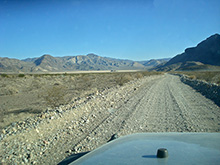
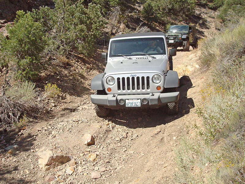
The bad section of the Phinney Canyon road where the rental jeep bottomed out was not far from the campsite. There we spent less than 10 minutes doing a little road improvement by filling a rut with rocks to raise the level of the tires on one side. This allowed the rental jeep to clear it easily.
For the drive back to the highway, we retraced our route from the first day, covering the 23-mile distance in a bit under 3 hours. This included an hour’s 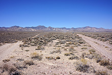 worth of stops, the longest being a half hour at the intersection of the Phinney Canyon and Strozzi Ranch roads, where we saw a dust devil cross the road and probably tossed a Frisbee. worth of stops, the longest being a half hour at the intersection of the Phinney Canyon and Strozzi Ranch roads, where we saw a dust devil cross the road and probably tossed a Frisbee.
We got back to NV 374 at 12:30pm. This intersection was just outside the park, but driving southwest on the perfectly straight road, we were back to the park border, and technically, inside the Nevada Triangle again, in 4 miles.  The road continued straight for 2 more miles, all the while ascending at a gentle, uniform grade. Then after a few curves we said good-bye to the Nevada Triangle, as we crossed into California. The California part of this road has no number—it’s simply called Daylight Pass Road, and unsurprisingly, a fraction of a mile later we reached the highest point of the road, 4317' at Daylight Pass. I always thought it interesting that the state border here, despite being an artificial straight line, also happens to cleanly divide two geographic regions: the Amargosa Range on the California side and the Amargosa Desert on the Nevada side. The fact that Daylight Pass is also nearly on that border seems like an unlikely coincidence, as the road was probably not here when they drew that line. The road continued straight for 2 more miles, all the while ascending at a gentle, uniform grade. Then after a few curves we said good-bye to the Nevada Triangle, as we crossed into California. The California part of this road has no number—it’s simply called Daylight Pass Road, and unsurprisingly, a fraction of a mile later we reached the highest point of the road, 4317' at Daylight Pass. I always thought it interesting that the state border here, despite being an artificial straight line, also happens to cleanly divide two geographic regions: the Amargosa Range on the California side and the Amargosa Desert on the Nevada side. The fact that Daylight Pass is also nearly on that border seems like an unlikely coincidence, as the road was probably not here when they drew that line.
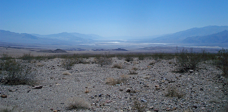
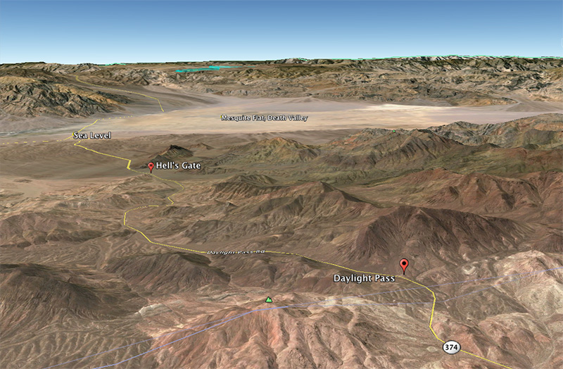
From Daylight Pass the road descends steeply and relentlessly 4400' in 6 miles, down to 50' below sea level at its lowest. The first part is somewhat windy, obviously descending between the mountains (Grapevine Mountains on right and Funeral Mountains on left). On the way, approximately half way down, we stopped for 9 minutes at Hell’s Gate (2261'), which is really the first place to park in Death Valley, just a small lot with a picnic table and a bathroom. There’s nothing here reminiscent of a gate—it’s just open country—but it probably has that name because it’s the first unobstructed view of Death Valley when coming down from the mountains, and names in Death Valley tend to emphasize the underworld. While we were here another car also stopped. This point is also the intersection with a secondary paved road to the left called Beatty Cutoff that provides a shortcut to the highway if you’re heading south toward Furnace Creek.
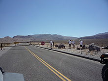
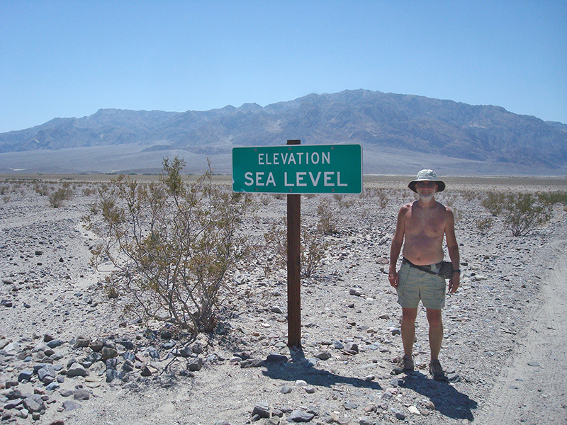
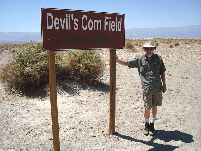
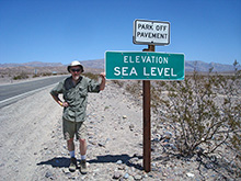 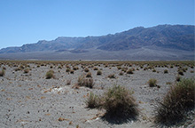 Nine minutes after Hell’s Gate, we reached CA 190, the only east-west highway that cuts through Death Valley, and in another 5 minutes, at 1:15pm, we reached sea level, where we took the obligatory photos. Heading southwest, the road continues to drop, but very gradually, to its lowest point, 50' below sea level at Devil’s Cornfield. Here the landscape is mostly sand and shrubs. Most people don’t know that the name comes from the arrowweed shrubs that look like mounds of dry weeds on sand stalks, some over 8' high. Nine minutes after Hell’s Gate, we reached CA 190, the only east-west highway that cuts through Death Valley, and in another 5 minutes, at 1:15pm, we reached sea level, where we took the obligatory photos. Heading southwest, the road continues to drop, but very gradually, to its lowest point, 50' below sea level at Devil’s Cornfield. Here the landscape is mostly sand and shrubs. Most people don’t know that the name comes from the arrowweed shrubs that look like mounds of dry weeds on sand stalks, some over 8' high.
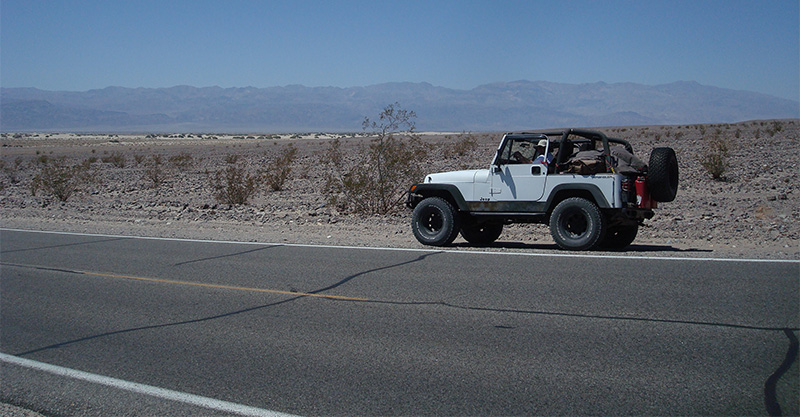
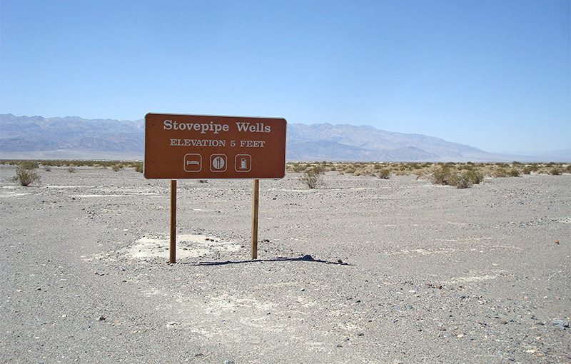
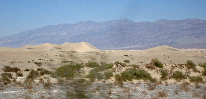
A few minutes later we whizzed by the largest and most accessible Sand Dunes in Death Valley, a major destination for most Death Valley tourists, but not for us today, in the middle of August. Right after that, at 1:30pm, we came to Stovepipe Wells Village, one of only two places to get gas and supplies on this east-west road (the other being Panamint Springs, 30 miles west on the other side of the Panamint Mountains). The temperature was north of 100º, but I didn’t record the exact value—hot but still tolerable, for driving anyway. In addition to a store, Stovepipe Wells has a restaurant, campground and motel. There was also a ranger station, where we asked about getting to Mahogany Flat and Telescope Peak. We didn't get much information from the ranger, other than the roads were still closed, and that it would be a long time before they would be fixed due to funding.
Despite the bad news, we decided to go for it anyway, as the Emigrant Canyon Road turnoff to Mahogany Flat was only 9 miles away. I was hoping that, while the road was “officially” closed, it was not literally closed and perhaps 4WD vehicles could still negotiate it. This is what I heard people were doing on the Panamint Valley Road which was likewise closed for months after the floods, so I assumed closure was more of a formality. Also on my mind was another major road near the park into Saline Valley that has been permanently marked closed for years, yet everyone uses it and authorities are OK with it.
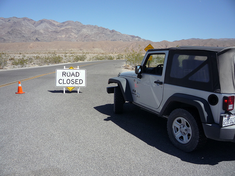
 We left Stovepipe Wells after 35 minutes after gas and ice cream, and got to Emigrant junction where the Emigrant Canyon Road starts at 2:25pm. Here we saw only a closed sign and some cones across the road, that we easily drove around, but a minute further up was a locked gate. On either side of the gate were huge boulders, maybe 300-500 lbs blocking all routes around the gate. However on one side we saw tracks obviously made by people who had moved one of the smaller boulders to get through. That boulder was back, but we thought we might be able to move it away again. Somehow I didn’t think this was all that illegal, and anyway those tracks indicated there was precedent. We left Stovepipe Wells after 35 minutes after gas and ice cream, and got to Emigrant junction where the Emigrant Canyon Road starts at 2:25pm. Here we saw only a closed sign and some cones across the road, that we easily drove around, but a minute further up was a locked gate. On either side of the gate were huge boulders, maybe 300-500 lbs blocking all routes around the gate. However on one side we saw tracks obviously made by people who had moved one of the smaller boulders to get through. That boulder was back, but we thought we might be able to move it away again. Somehow I didn’t think this was all that illegal, and anyway those tracks indicated there was precedent.
So several of us (I think Bob, Greg and Bobby) got out and started rocking the boulder back and forth repeatedly. It was promising to roll if we could just get enough momentum. While they were working on the boulder, and I was sitting in my jeep, a pickup truck appeared, coming at us down the closed side of the gate. At first I thought it might be other off-roaders that made it around the gate, but soon I realized it was an official maintenance crew. I wanted to yell to the other guys to stop, but if I did that the people in the truck would hear me, and it would be obvious we were up to no good. The guys moving the boulder were oblivious, still rocking it back and forth even as the pickup truck pulled right up to the gate a few feet from them. Finally they saw the truck and backed away, duly spooked. Perhaps if questioned we could say we were just having fun rocking the boulder. After all there was no proof we were trying to drive around the gate. One of the guys in the truck got out to unlock the gate to get out, acting as if he couldn’t care less what we were doing. We spoke to him and he said they were working on repairs up at the campground. We asked about driving up there and he said that the road is actually fine, but it’s officially closed, with a $250 fine per person if we were caught there. But he was not a cop or ranger, so they just drove on, while our hopes for Telescope Peak this trip were dashed.
So we now had a dilemma. With temperatures over 100º here and Mahogany Flat inaccessible, we had to get to a higher elevation tonight. We had talked about going to Cerro Gordo later on this trip, with the possibility of camping above 9000' near the Burgess Mine, but the road to get us there (called the Swansea Grade) was going to be too challenging for our rental jeep. I decided instead that we should head to the White Top Mountain Road, where we could camp near 7000' for 2-3 nights in the heart of the Cottonwood Mountains and spend the days exploring its summits and canyons.
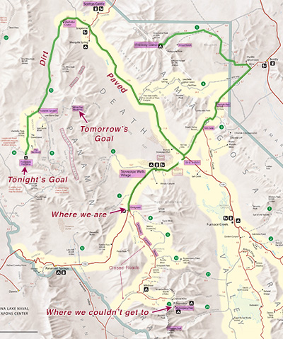 The only problem with this new plan was that it was 2:30pm, and getting to the end of the White Top Road involved 55 miles on a paved road that would take at least an hour, 23 miles on a dirt road that might be rutted enough to take over an hour, and then 10 miles on a remote road of unknown condition that could take as much as 2 hours. So in the best case if we rushed and made no stops, we were looking at a 6:30pm arrival, and rushing is no fun in Death Valley. So I suggested instead that tonight we do just the first two legs of that drive, but then go 10 miles out of our way to the Racetrack, and head up to White Top the next day. The Racetrack was only at 3750', but that would still be 20º cooler than the valley and I figured we could brave the heat for one night, especially since we would be there only in the evening and morning. Also, the Racetrack is the flattest, maybe most beautiful playa in the U.S. It’s worth a trip by itself, and Bob and Danny had never been there. The only problem with this new plan was that it was 2:30pm, and getting to the end of the White Top Road involved 55 miles on a paved road that would take at least an hour, 23 miles on a dirt road that might be rutted enough to take over an hour, and then 10 miles on a remote road of unknown condition that could take as much as 2 hours. So in the best case if we rushed and made no stops, we were looking at a 6:30pm arrival, and rushing is no fun in Death Valley. So I suggested instead that tonight we do just the first two legs of that drive, but then go 10 miles out of our way to the Racetrack, and head up to White Top the next day. The Racetrack was only at 3750', but that would still be 20º cooler than the valley and I figured we could brave the heat for one night, especially since we would be there only in the evening and morning. Also, the Racetrack is the flattest, maybe most beautiful playa in the U.S. It’s worth a trip by itself, and Bob and Danny had never been there.
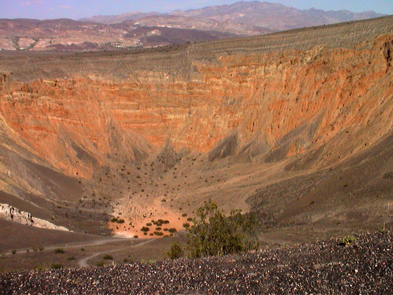
So we drove back down CA 190 the way we came, past Stovepipe Wells and to the intersection with the Daylight Pass Road in 17 miles. This is also the intersection with the paved Scotty’s Castle Road that goes north parallel to the valley, at the western base of the alluvial fans of the Grapevine Mountains. We turned onto that road and went north 32 miles to its intersection with the Grapevine Canyon Road that goes to Scotty’s Castle in 3 miles. I hear Scotty’s Castle is worth seeing and I don’t think any of us had been there, but we didn’t have time to do it today. Instead we kept straight, going another 5 miles to Ubehebe Crater, where the paved road turns to dirt. Ubehebe Crater is also worth a stop and a hike, but not today.
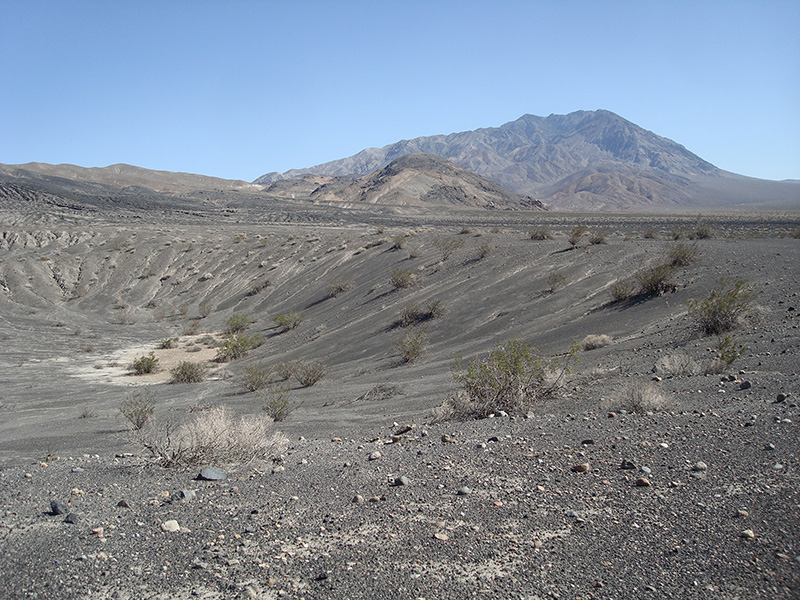
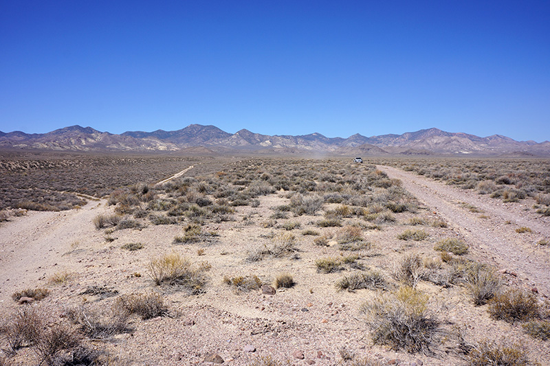
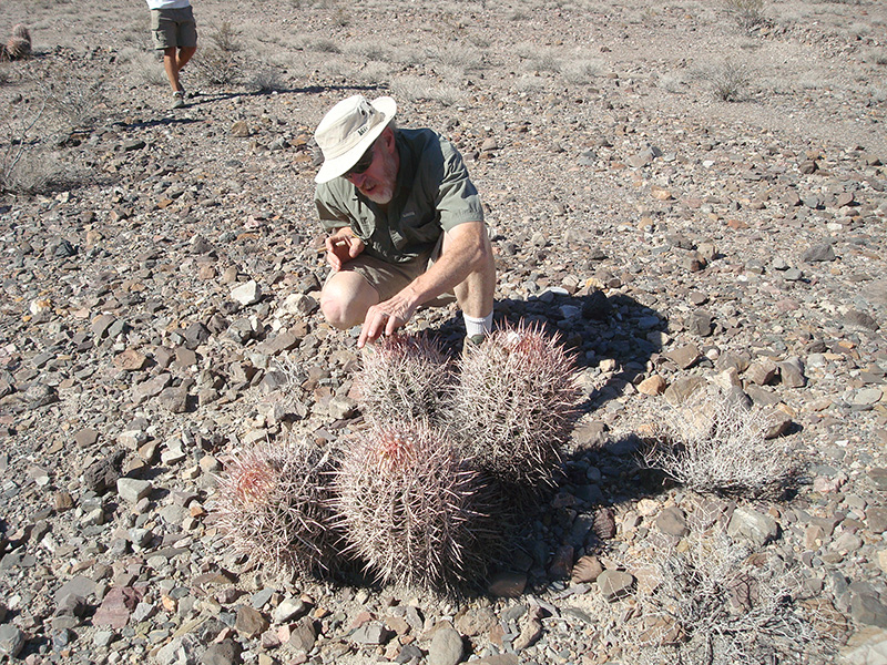
 At this point, 55 miles from where we turned around, it was 3:40, just a little more than the 1-hour estimate I made for the paved stretch of the drive. Of course it helped that we drove it at a breakneck speed of 50mph rather than stopping at every interesting thing on the way. (We didn’t dare go faster with aired down tires.) There are lots of tempting Frisbee spots right after Ubehebe Crater, so we stopped soon after it turned to dirt. The landscape here is a vast, perfectly smooth and flat plane made of dark gravel, At this point, 55 miles from where we turned around, it was 3:40, just a little more than the 1-hour estimate I made for the paved stretch of the drive. Of course it helped that we drove it at a breakneck speed of 50mph rather than stopping at every interesting thing on the way. (We didn’t dare go faster with aired down tires.) There are lots of tempting Frisbee spots right after Ubehebe Crater, so we stopped soon after it turned to dirt. The landscape here is a vast, perfectly smooth and flat plane made of dark gravel,  with the only vegetation being 5' high shrubs spaced about 30' apart. We got out and spent 25 minutes, walking about 200' from the road to peer down a small crater 500' wide and 50' deep with a sand bottom, and getting our “cactus toothpicks”. We undoubtedly had a beer, and maybe we even tried some Aerobie, but it was likely too windy. One vehicle (a compact car) passed by us, going in our direction. with the only vegetation being 5' high shrubs spaced about 30' apart. We got out and spent 25 minutes, walking about 200' from the road to peer down a small crater 500' wide and 50' deep with a sand bottom, and getting our “cactus toothpicks”. We undoubtedly had a beer, and maybe we even tried some Aerobie, but it was likely too windy. One vehicle (a compact car) passed by us, going in our direction.
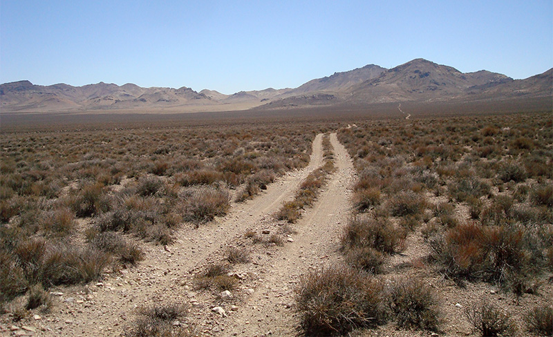
The dirt road from here, the Racetrack Valley Road, is normally 2WD condition and cars with street tires drive these 28 miles to the Racetrack all the time. But the road is also notorious for its washboard, which forms because it’s so straight and easy that people go way too fast. As a result, there are sections where you feel like you are getting beaten to death, where 15 mph is hard to take. Cars with high pressure street tires that drive too fast often get flats from sharp rocks. The condition varies greatly depending on how recently it was graded, but I think it deteriorates so fast that they can’t grade it often enough to keep it smooth.
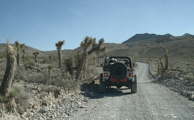
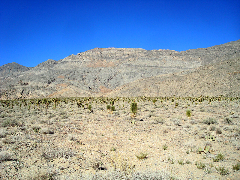
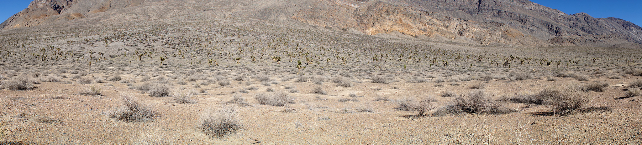
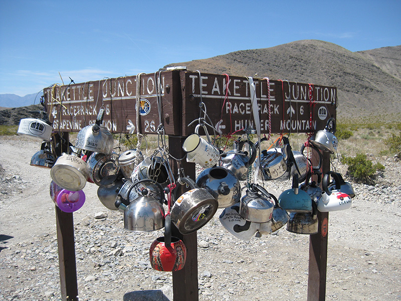
 In the next half hour we covered 9 miles at an average blinding speed of 16 mph, because the road was actually quite good today. Here we entered a wonderful stretch of Joshua Tree forest In the next half hour we covered 9 miles at an average blinding speed of 16 mph, because the road was actually quite good today. Here we entered a wonderful stretch of Joshua Tree forest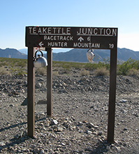 (make your browser window as wide as possible before clicking on this link) and we had to stop repeatedly for pictures. The next 10 miles was equally fast, and by 5:15pm we got to Teakettle Junction. Straight ahead is the Racetrack where we are headed tonight, and left goes to Ulida Flat, eventually leaving the national park over Hunter Mountain. The White Top Road where we are going tomorrow is in the Ulida Flat direction. (make your browser window as wide as possible before clicking on this link) and we had to stop repeatedly for pictures. The next 10 miles was equally fast, and by 5:15pm we got to Teakettle Junction. Straight ahead is the Racetrack where we are headed tonight, and left goes to Ulida Flat, eventually leaving the national park over Hunter Mountain. The White Top Road where we are going tomorrow is in the Ulida Flat direction.
Teakettle Junction is so called because of a signpost from which people traditionally hang teakettles, with paintings and inscriptions on them. It gets to be dozens of teakettles, so periodically someone, perhaps the park service, thins them to make room for more. Alas, we hit it at a bad time this year: there were only two, one of them probably surviving because it was attached with a bicycle lock. Click here to see how it looked a year later.
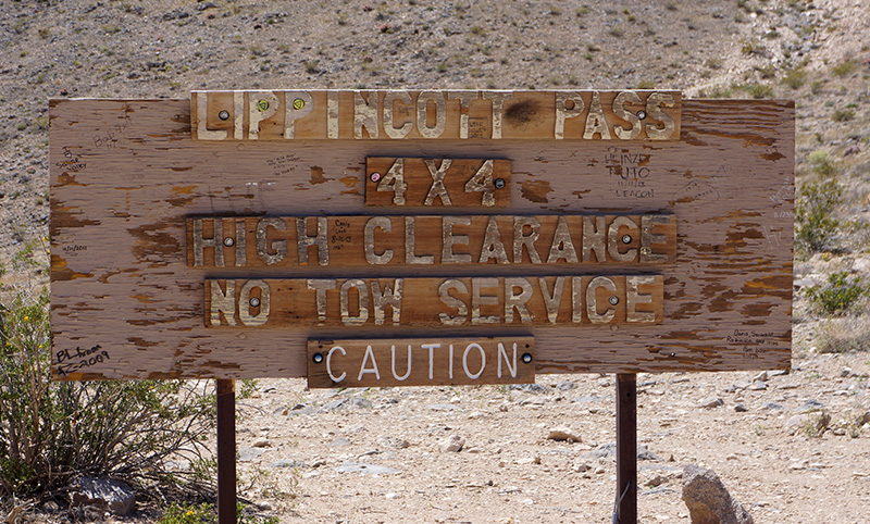
We spent only 2 minutes at the junction before moving on. We weren’t just going to the Racetrack, but a couple of miles beyond its end, to Homestake Dry Camp, where the only way out is the infamous 4WD Lippincott Road. We didn’t really want to drive all those 10 miles, but that’s the first place after this junction where camping is allowed. In retrospect we might have been able to find a campsite near here prior to Teakettle Junction, and it would have been a few degrees cooler at 4200', but we had the time and the Racetrack is always fun to see.
 I was surprised how good the road had been up to here, but now it finally revealed its true self, a severe washboard. It felt like the vibrations must be loosening every bolt in the jeep, and maybe even unscrewing all the food jars. Despite the suffering, we still made pretty good time, and reached the campsite in 30 minutes, at 5:45pm. But for the first time this trip, we weren’t at the campsite by 5:00. I was surprised how good the road had been up to here, but now it finally revealed its true self, a severe washboard. It felt like the vibrations must be loosening every bolt in the jeep, and maybe even unscrewing all the food jars. Despite the suffering, we still made pretty good time, and reached the campsite in 30 minutes, at 5:45pm. But for the first time this trip, we weren’t at the campsite by 5:00.
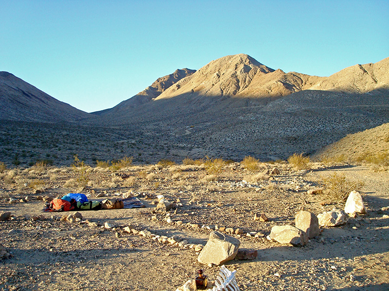
It’s a stretch to call Homestake Dry Camp a “campground”: it’s just series of 2-3 pullouts next to the road. But it’s one of only 3 designated campsites in Death Valley that we have ever stayed at (the others are Mahogany Flat by Telescope Peak and Eureka Dunes). I call this “designated” and not “developed” because the only development here besides the pullouts is a single pit toilet in fairly poor condition. But for Greenshitting, it was perfect. We chose a very large spot a couple hundred feet beyond the toilet, where everyone could have their own private sleeping berth neatly outlined in rocks.
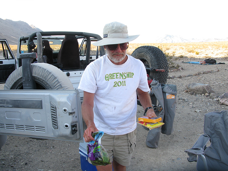
Even though we got to it later than usual, setting up camp was quick, and we finished dinner (hot dogs and beans) before dark. While we were here a another vehicle pulled up at a site near the outhouse. It looked like there was one person who slept in his vehicle and pulled out early the next morning, and we never talked to him.
 Since it was not quite dark yet, we decided for our “night hike” to drive 2 miles back to the southern end of the Racetrack and try some Frisbee, bringing two illuminated ones to use after dark. In fact, we had both illuminated ones going at the same time in reverse directions. This got very funny because the lights on one of the Frisbees would randomly go dark, usually the instant it was tossed, so the receiver had no idea where it was, risking a smack in the face. We had a very long game, despite the challenging wind. Since it was not quite dark yet, we decided for our “night hike” to drive 2 miles back to the southern end of the Racetrack and try some Frisbee, bringing two illuminated ones to use after dark. In fact, we had both illuminated ones going at the same time in reverse directions. This got very funny because the lights on one of the Frisbees would randomly go dark, usually the instant it was tossed, so the receiver had no idea where it was, risking a smack in the face. We had a very long game, despite the challenging wind. 
|


