|
T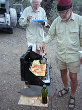 his morning was again our warmest, 58°, despite the elevation. This could be due to the “heat rises” phenomenon on still, clear nights, as it might very well have been colder down in the valleys. Instead of plain eggs that was scheduled for breakfast, we made an omelet with an 8 oz package of lox left over from the 1st day and an 8 oz block of cheddar cheese, plus hot sausage on the side. his morning was again our warmest, 58°, despite the elevation. This could be due to the “heat rises” phenomenon on still, clear nights, as it might very well have been colder down in the valleys. Instead of plain eggs that was scheduled for breakfast, we made an omelet with an 8 oz package of lox left over from the 1st day and an 8 oz block of cheddar cheese, plus hot sausage on the side.
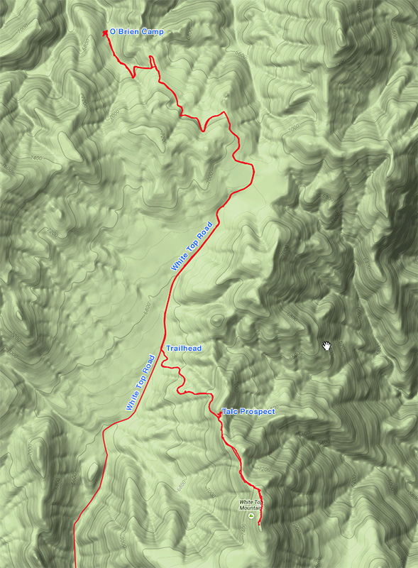
 Our last big hike of the trip was to be White Top Mountain at 7607', one of the more prominent summits of the Cottonwood mountains (the highest being Tin Mountain to our north at 8953'). The easiest way up, which I saw on the way in, began 2.5 miles back on the White Top Road, on a closed mining road. From there it looked like an easy grade of 1½ miles to the summit, with just 1000' elevation gain. Given that, I suggested we could make it a full day by walking to the trailhead from the campsite, rather than driving. I reasoned the extra 5 miles round trip would add about 2.5 hours, time we easily had. Also, it was unlikely to be very hot at this elevation, so it’s a good opportunity to walk. Our last big hike of the trip was to be White Top Mountain at 7607', one of the more prominent summits of the Cottonwood mountains (the highest being Tin Mountain to our north at 8953'). The easiest way up, which I saw on the way in, began 2.5 miles back on the White Top Road, on a closed mining road. From there it looked like an easy grade of 1½ miles to the summit, with just 1000' elevation gain. Given that, I suggested we could make it a full day by walking to the trailhead from the campsite, rather than driving. I reasoned the extra 5 miles round trip would add about 2.5 hours, time we easily had. Also, it was unlikely to be very hot at this elevation, so it’s a good opportunity to walk.
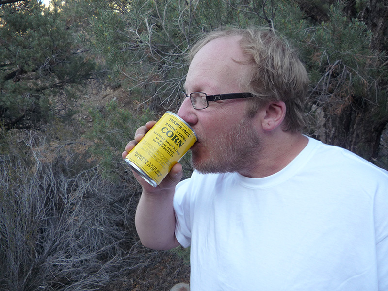
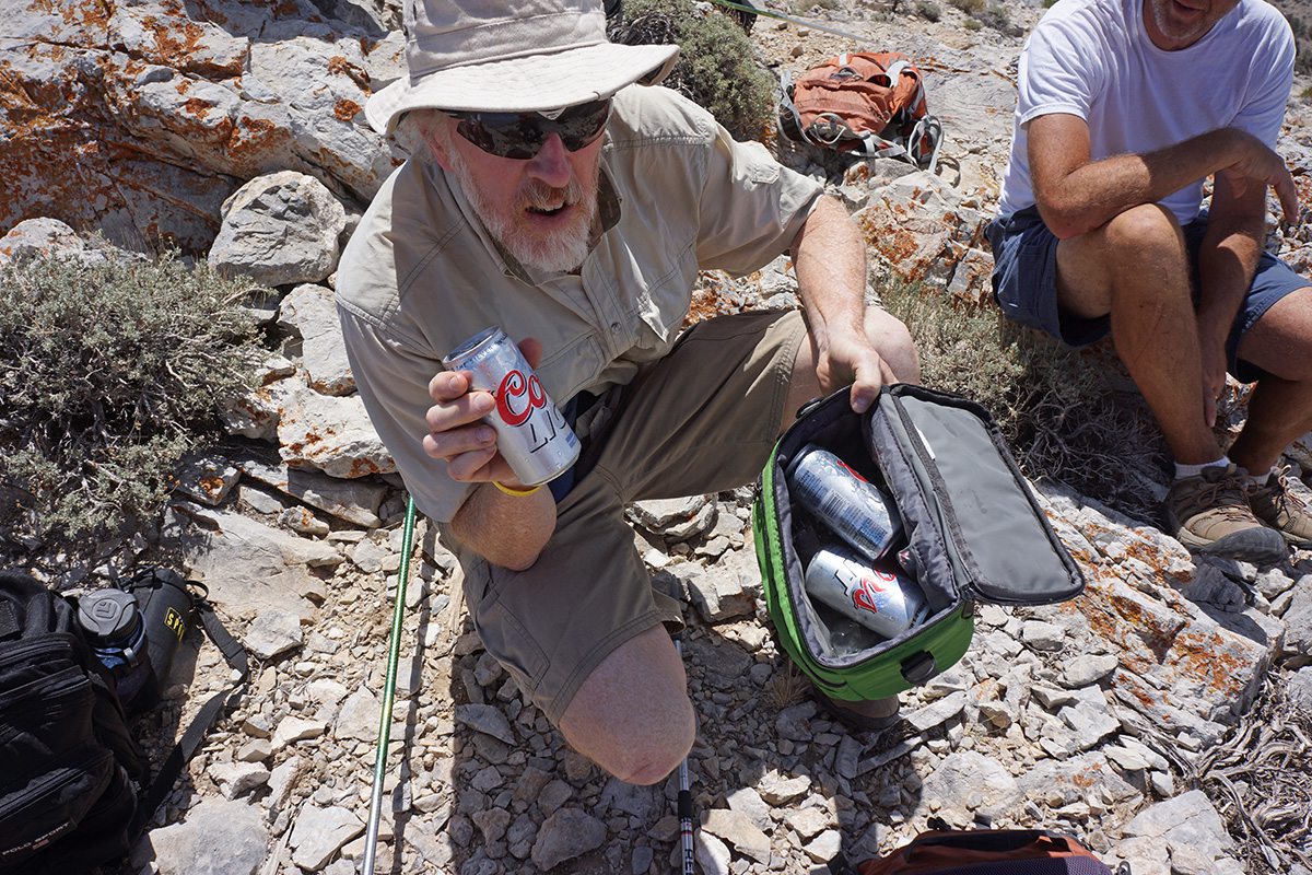
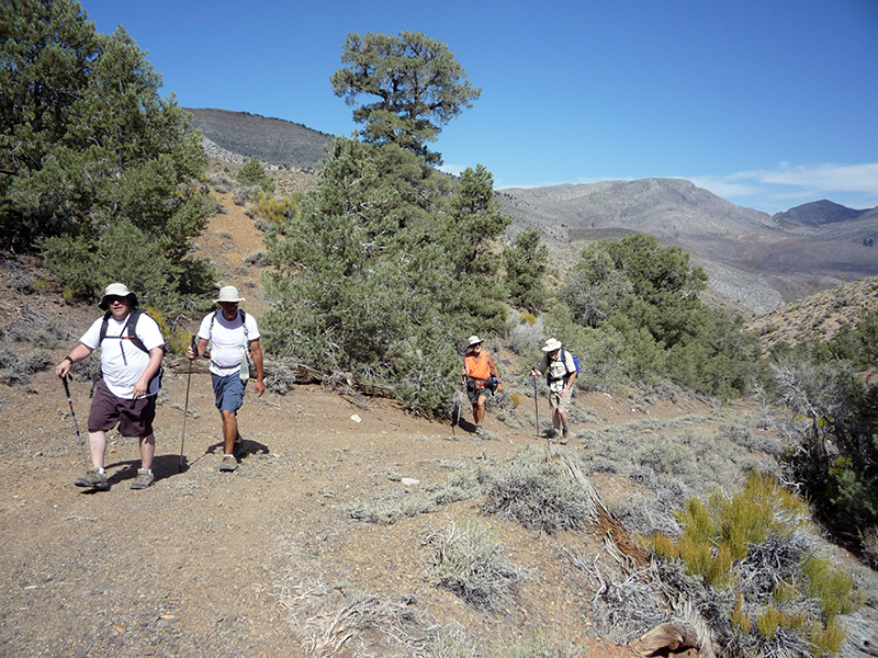
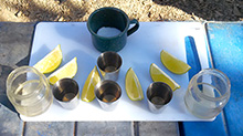 We topped off our morning chores with eye openers, and prepared for the hike. Bob tried a Greenshit first, packing four beers and ice in one of the foam coolers. These coolers had been holding water pretty well, so we reasoned that the beers would stay cold in his pack even if the ice melted. We topped off our morning chores with eye openers, and prepared for the hike. Bob tried a Greenshit first, packing four beers and ice in one of the foam coolers. These coolers had been holding water pretty well, so we reasoned that the beers would stay cold in his pack even if the ice melted.
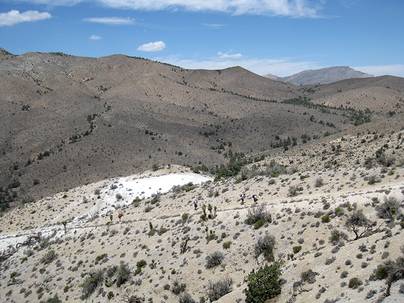
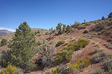 We started down the road at 10:15am and soon popped out into the open where we had wide vistas. Except for some thin stratus clouds in the distance, the sky was as clear as the other days. Compared to driving, walking gave us more time to admire the view and the colorful terrain. The first ¼ mile of the road was a gentle 200' rise into a layer of red shale or sandstone, a nice contrast to the more neutral and We started down the road at 10:15am and soon popped out into the open where we had wide vistas. Except for some thin stratus clouds in the distance, the sky was as clear as the other days. Compared to driving, walking gave us more time to admire the view and the colorful terrain. The first ¼ mile of the road was a gentle 200' rise into a layer of red shale or sandstone, a nice contrast to the more neutral and 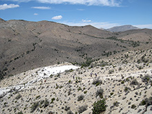 yellowish colors of the neighboring landscape. Some peaks of the Cottonwood Mountains were visible, and we had glimpses of the northern end of Death Valley on the other side of the Cottonwoods where we were on the paved road yesterday. yellowish colors of the neighboring landscape. Some peaks of the Cottonwood Mountains were visible, and we had glimpses of the northern end of Death Valley on the other side of the Cottonwoods where we were on the paved road yesterday.
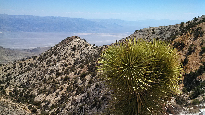
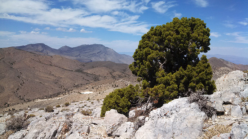
We arrived at the mine road to White Top Mountain at 11:40, just a little past the ranch where we stopped at on the way in. The mine road was much steeper than the White Top Road, but walking was still easy. The only trees from here to the top were occasional Joshua trees, so there was nothing to obscure our views as we ascended.
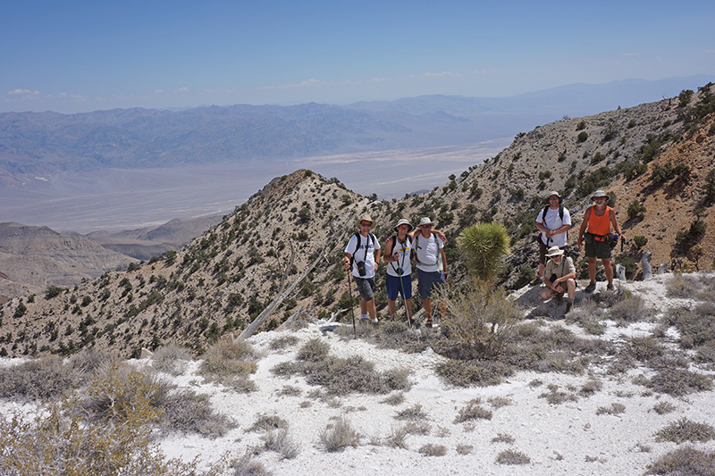
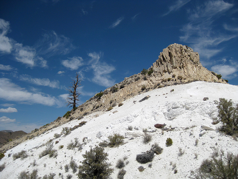
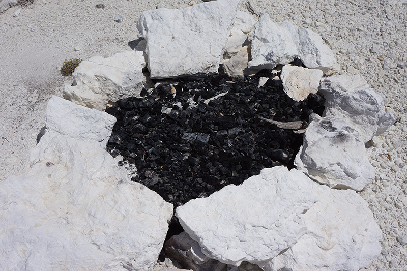
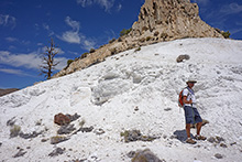  At several spots within the first mile we came to sections of very white sand, gravel and rock, probably tailings from a talc mine. The last one was quite extensive and included a prospect. It was blindingly bright. We spent 15 minutes here walking up into the whiteness. There were some fire rings with burnt wood here, where people obviously camped, but I wondered why they would go to the trouble to camp ¾ of a mile from the road. They couldn’t have been backpackers because there is no wood here to burn (and besides, it’s illegal to burn wood in Death Valley). Where this white ground ended there was a little butte, about 25' high, which Greg and Bobby climbed. At several spots within the first mile we came to sections of very white sand, gravel and rock, probably tailings from a talc mine. The last one was quite extensive and included a prospect. It was blindingly bright. We spent 15 minutes here walking up into the whiteness. There were some fire rings with burnt wood here, where people obviously camped, but I wondered why they would go to the trouble to camp ¾ of a mile from the road. They couldn’t have been backpackers because there is no wood here to burn (and besides, it’s illegal to burn wood in Death Valley). Where this white ground ended there was a little butte, about 25' high, which Greg and Bobby climbed.
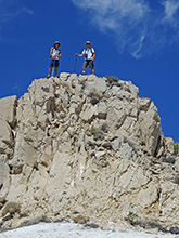
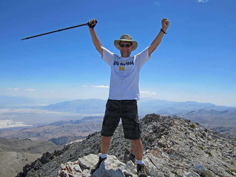
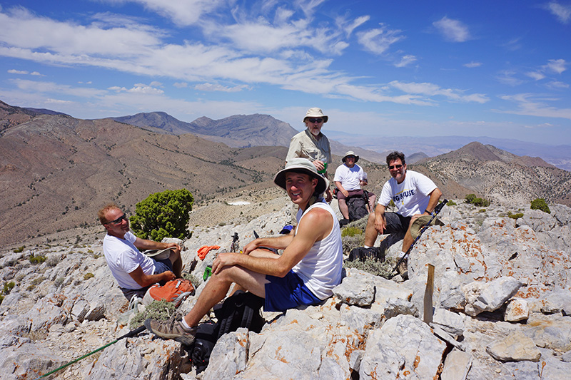
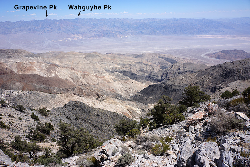
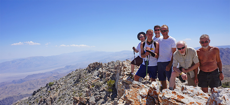
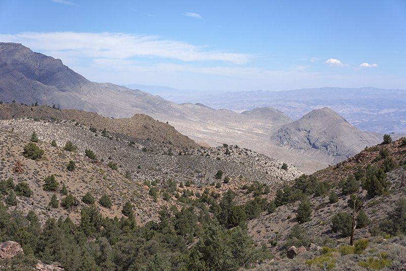
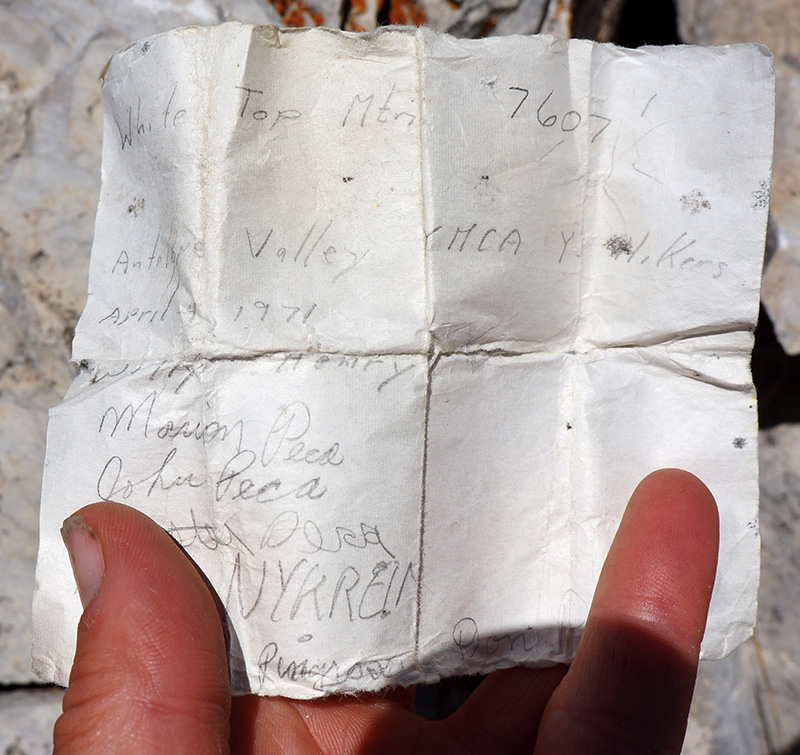
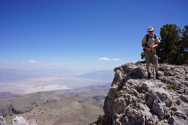
 The mine road ended at this prospect, so from here we made our own trail. Within a minute or two beyond the prospect we reached the main ridge, where we could see down the east side into northern Death Valley and to the Grapevine Mountains beyond. We now just had to hike this ridge to the top. The footing was pretty The mine road ended at this prospect, so from here we made our own trail. Within a minute or two beyond the prospect we reached the main ridge, where we could see down the east side into northern Death Valley and to the Grapevine Mountains beyond. We now just had to hike this ridge to the top. The footing was pretty 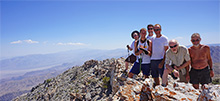 rough at first, but it soon smoothed out. There was a somewhat steep section around 7400', and then the last bit to the summit was very gradual again. Overall, this was the least strenuous of our hikes this trip. We reached the top at 1pm, and as always, there was a register, where we logged our accomplishment. The register must have been here for a while—we found an entry from 1971! rough at first, but it soon smoothed out. There was a somewhat steep section around 7400', and then the last bit to the summit was very gradual again. Overall, this was the least strenuous of our hikes this trip. We reached the top at 1pm, and as always, there was a register, where we logged our accomplishment. The register must have been here for a while—we found an entry from 1971!
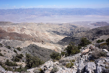
The view from the top at 7607' was not much different from the view we had on the ridge—the summit seemed like just a bump on the ridge. Tin Mountain, plainly visible, was clearly much higher. But another major peak almost as high, Dry Mountain, was blocked from our view by a 6000' arm of the Cottonwoods on the other side of the White Top Road. Dry Mountain is in the Last Chance Range that marks the 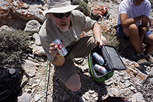 western side of Racetrack Valley. western side of Racetrack Valley.
But the best part of all was when Bob took out four ice cold beers from his cooler. In fact, there was enough ice left for us to freeze our heads, which made some people yell very loudly. 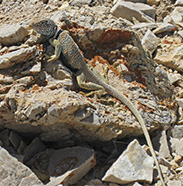 We had plenty of time to relax on top, have lunch, and pose at the edges of cliffs. We had plenty of time to relax on top, have lunch, and pose at the edges of cliffs.
After about an hour we started down. A little below the summit we saw a colorful Great Basin Collared Lizard. The 1.3-mile hike back to the road took a little over an hour, and the walk back on the road took 1¼ hours, all considerably faster than it took this morning. We were back to camp at 4:10pm.
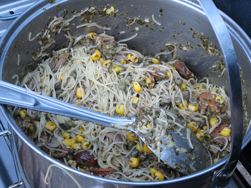
Our last appetizer of the trip was particularly tasty: a jar of pickled asparagus. We must have spent a long time just sitting and talking, because we were still cooking dinner at 6:15. We had the pasta and pesto, augmented by a can of corn and the second package of Andouille sausage that we forgot to use for the jambalaya. It was a hearty last meal.
While sitting around after dinner, a bat flew around our campsite. Bats are cute and we see them often, so we didn’t think much of this. But this bat stuck around, repeatedly flying through our campsite. It was kind of creepy, especially when it bumped into Joey. After a few minutes of this we decided the bat was being too weird and had to go. Bats can be rabid and most of the one or two cases per year of human rabies in the U.S. are from bats. We were eventually able to make it leave by swatting it with a coat. After that, instead of a night hike, we drank a whole bottle of Carolans Irish cream, another Greenshit first, thanks to Bob. 
|


