|
A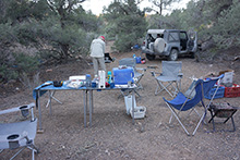 s far as we could tell from the amount of sky visible at our campsite, yet another boring, cloudless day was in our future. It’s convenient that with 6 people, we could use a a whole dozen eggs and package of bacon for breakfast, so we didn’t have to put any leftovers back in the cooler. By 7am we could see the sun illuminating the walls of our canyon, and it appeared that it would reach down here to the campsite in an hour or two, but we had so much shade under the pines that it probably didn’t matter. s far as we could tell from the amount of sky visible at our campsite, yet another boring, cloudless day was in our future. It’s convenient that with 6 people, we could use a a whole dozen eggs and package of bacon for breakfast, so we didn’t have to put any leftovers back in the cooler. By 7am we could see the sun illuminating the walls of our canyon, and it appeared that it would reach down here to the campsite in an hour or two, but we had so much shade under the pines that it probably didn’t matter.
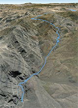
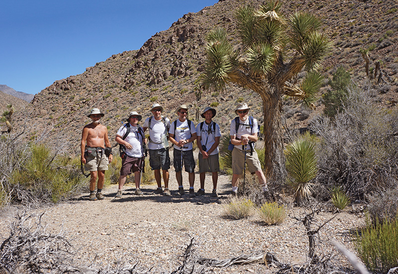
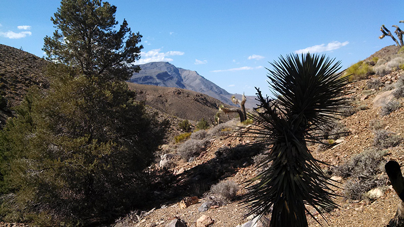
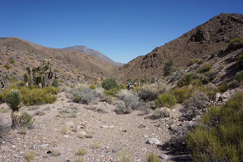
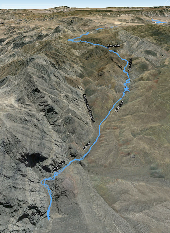
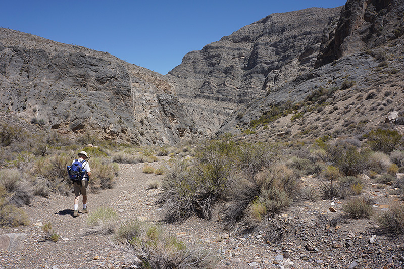
  For our hike down the canyon today we had no specific destination, other than seeing how close we could get to the Bighorn Gorge intersection. I knew we had to be cautious, reserving enough time and energy for the hike back, because it would be all uphill in the hottest part of the day. We got started a little after 10am, very soon passing the spot were we turned around last night. Immediately after that the canyon opened up, and it looked more like a broad wash in the center of a wide valley, with gently sloping sides. There were Joshua trees and pinyon pines sprinkled around. For our hike down the canyon today we had no specific destination, other than seeing how close we could get to the Bighorn Gorge intersection. I knew we had to be cautious, reserving enough time and energy for the hike back, because it would be all uphill in the hottest part of the day. We got started a little after 10am, very soon passing the spot were we turned around last night. Immediately after that the canyon opened up, and it looked more like a broad wash in the center of a wide valley, with gently sloping sides. There were Joshua trees and pinyon pines sprinkled around.
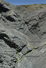
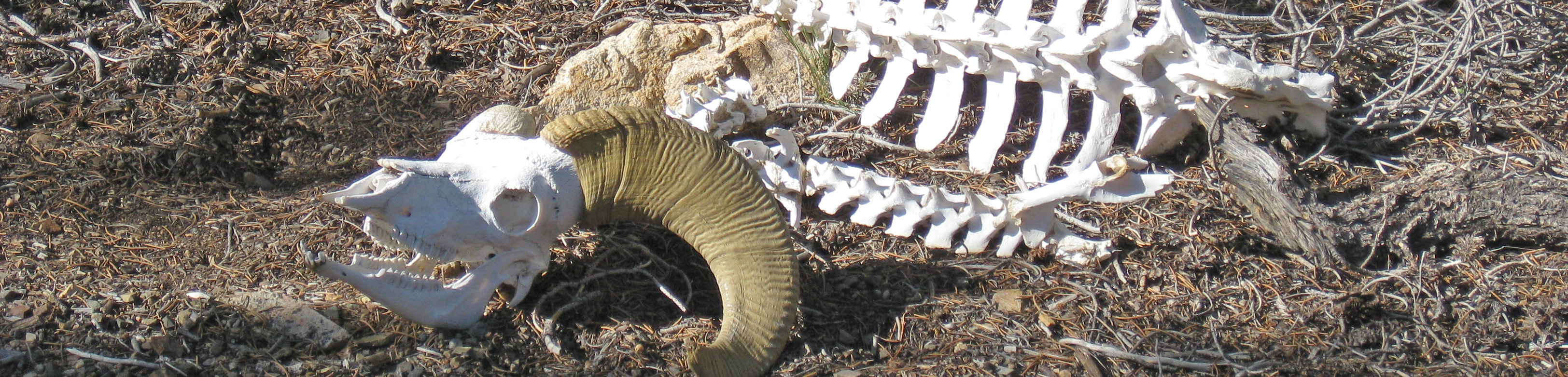
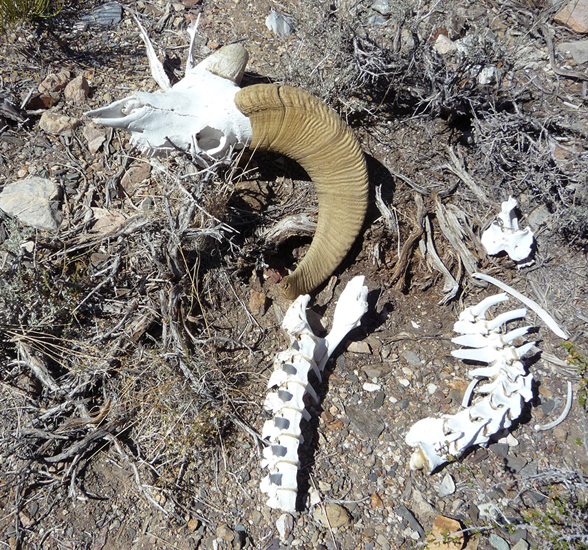
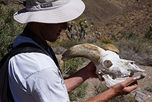 We intersected the “true” O’Brien Canyon, a major tributary of Bighorn Gorge, at 0.4 miles. In another 5 minutes, 0.6 miles from the start, we hit a spectacular find: next to a Joshua tree, a bighorn sheep skull, complete with jawbone and the sheath covering both horns. There was also part of the backbone. Bighorn Gorge lived up to its name! We intersected the “true” O’Brien Canyon, a major tributary of Bighorn Gorge, at 0.4 miles. In another 5 minutes, 0.6 miles from the start, we hit a spectacular find: next to a Joshua tree, a bighorn sheep skull, complete with jawbone and the sheath covering both horns. There was also part of the backbone. Bighorn Gorge lived up to its name!
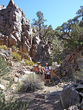
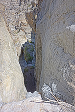
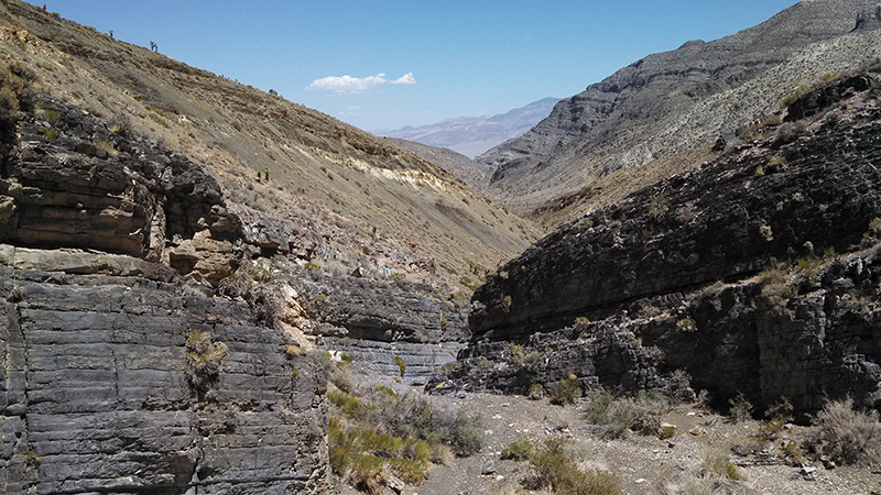
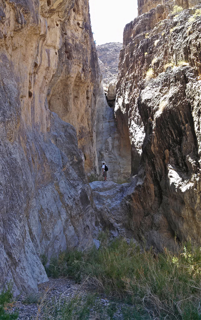
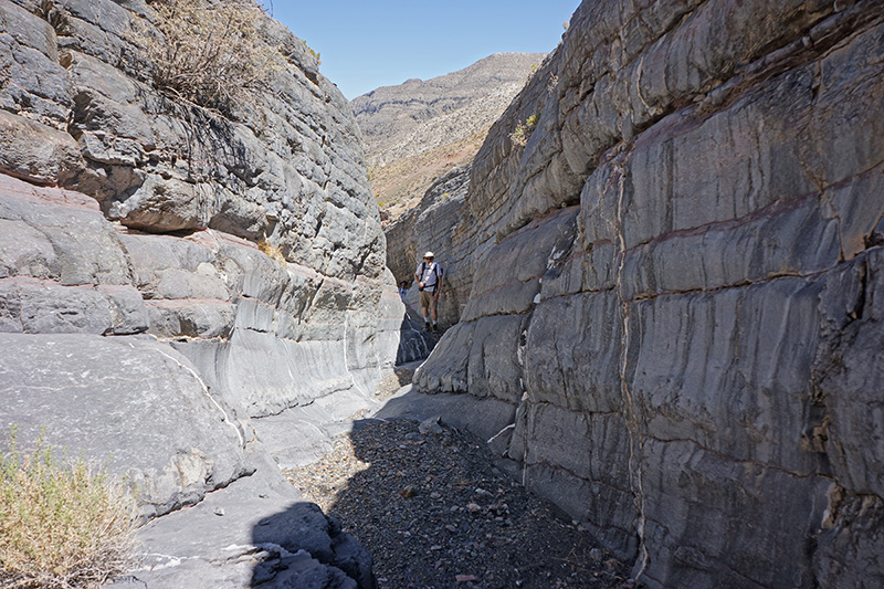
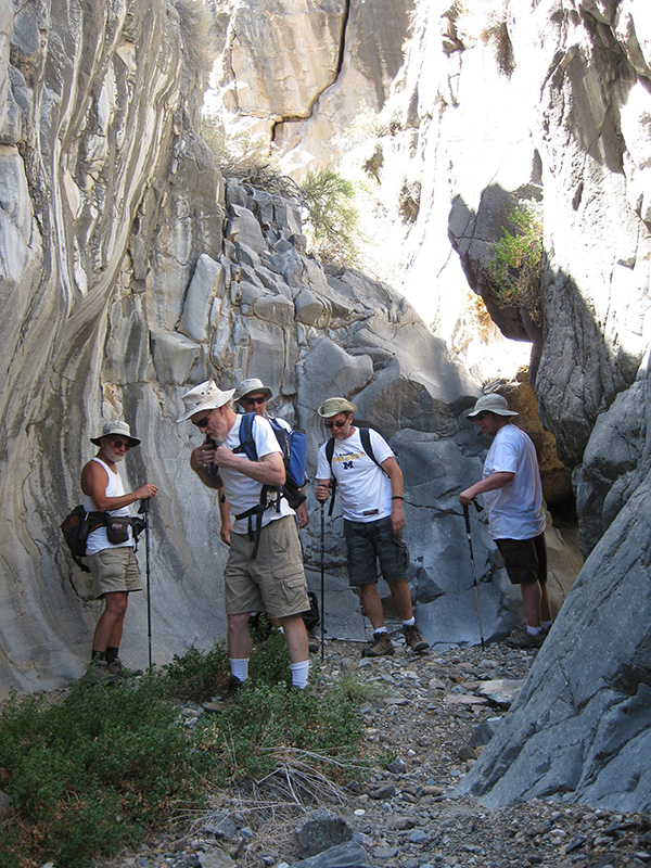
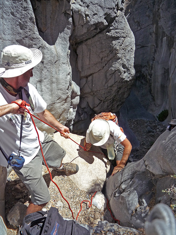
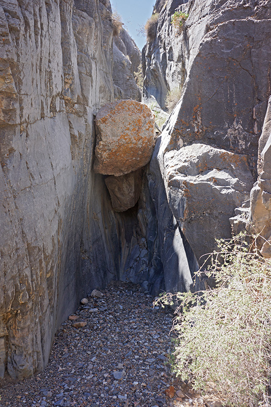
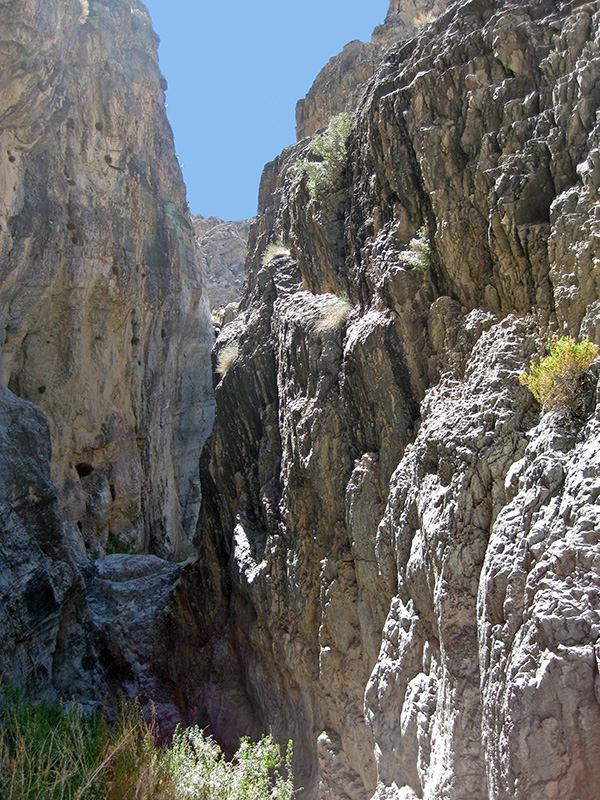
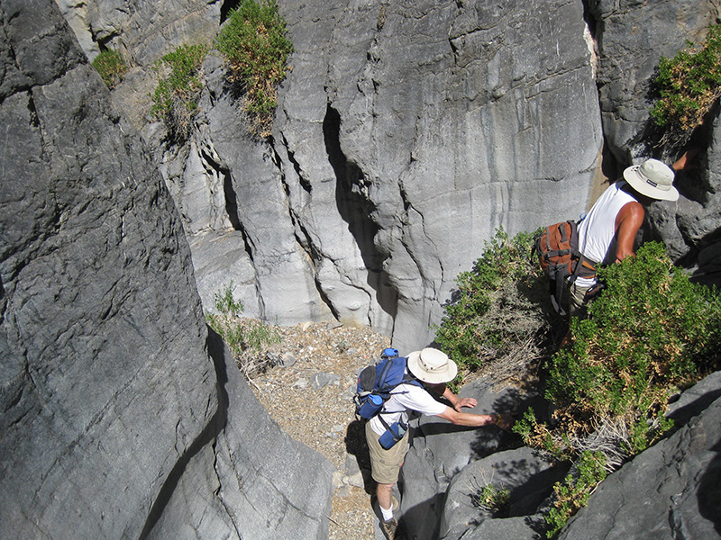
 The canyon eventually got narrow, at least in the very bottom where we were hiking. We went through a modest slot-like area and over some smooth rock slopes and chutes. At the The canyon eventually got narrow, at least in the very bottom where we were hiking. We went through a modest slot-like area and over some smooth rock slopes and chutes. At the 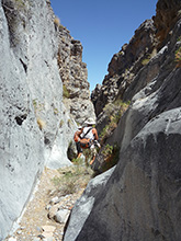 2.2 mile mark we came to nice narrows, which varied from 5-10' wide. It was comforting being in the shade for a while. Here we had to negotiate a couple of small falls, and then we came to a 12' fall that was a more serious obstacle. I’m not sure why getting past this required climbing up (since we were going downstream) but Greg climbed up first and set up a handline assist for the others, using a rope I always bring on canyon hikes. The main channel was soon blocked by a chockstone and overhanging drop. To get around this we backtracked and climbed up on the wall. The view down the canyon from here was spectacular. Soon we found a way back down, laying a cairn at the intersection with the main canyon, and then went a little back up the canyon to see the chockstone from below. 2.2 mile mark we came to nice narrows, which varied from 5-10' wide. It was comforting being in the shade for a while. Here we had to negotiate a couple of small falls, and then we came to a 12' fall that was a more serious obstacle. I’m not sure why getting past this required climbing up (since we were going downstream) but Greg climbed up first and set up a handline assist for the others, using a rope I always bring on canyon hikes. The main channel was soon blocked by a chockstone and overhanging drop. To get around this we backtracked and climbed up on the wall. The view down the canyon from here was spectacular. Soon we found a way back down, laying a cairn at the intersection with the main canyon, and then went a little back up the canyon to see the chockstone from below.
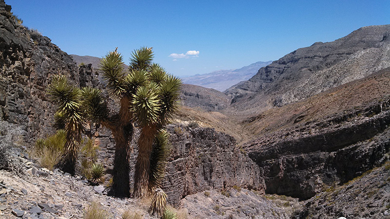
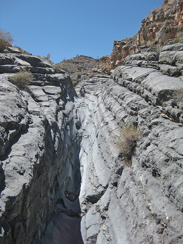
 The main canyon here remained narrow, under 10' wide with a flat bottom and 15' vertical walls. It became kind of like a chute and was fun to negotiate. But very soon it broadened to 50' or more, still with a flat bottom, and eventually it opened up so wide that it looked more like valley, a half mile across. With so much of the sky finally visible, we could see, for the first time this trip, some small clouds on the horizon. Soon, 3.9 miles from the start, another identical unnamed canyon merged with us on the right. The map showed this other canyon remained parallel to our canyon and could take us almost back to camp, except for a potentially very steep ascent at the end. Of course I would never suggest going back that way as I had no idea if it had impassable obstacles. It is probably safe to say that this intersection is the mouth of O’Brien Canyon and we are entering Bighorn Gorge. It’s debatable which of these two branches should really be considered “Upper” Bighorn Gorge instead of a separate canyon that branches from it. The main canyon here remained narrow, under 10' wide with a flat bottom and 15' vertical walls. It became kind of like a chute and was fun to negotiate. But very soon it broadened to 50' or more, still with a flat bottom, and eventually it opened up so wide that it looked more like valley, a half mile across. With so much of the sky finally visible, we could see, for the first time this trip, some small clouds on the horizon. Soon, 3.9 miles from the start, another identical unnamed canyon merged with us on the right. The map showed this other canyon remained parallel to our canyon and could take us almost back to camp, except for a potentially very steep ascent at the end. Of course I would never suggest going back that way as I had no idea if it had impassable obstacles. It is probably safe to say that this intersection is the mouth of O’Brien Canyon and we are entering Bighorn Gorge. It’s debatable which of these two branches should really be considered “Upper” Bighorn Gorge instead of a separate canyon that branches from it.
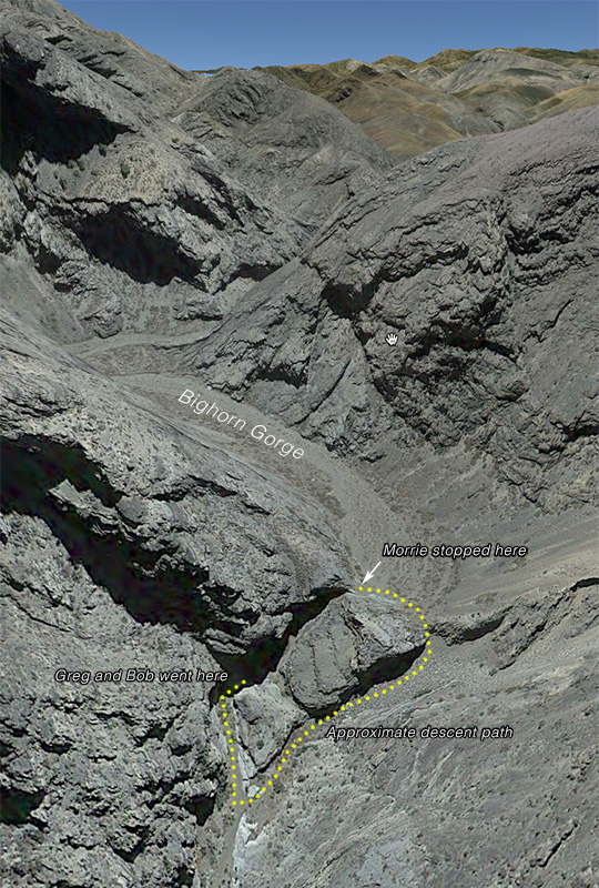
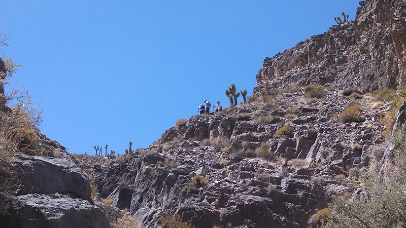
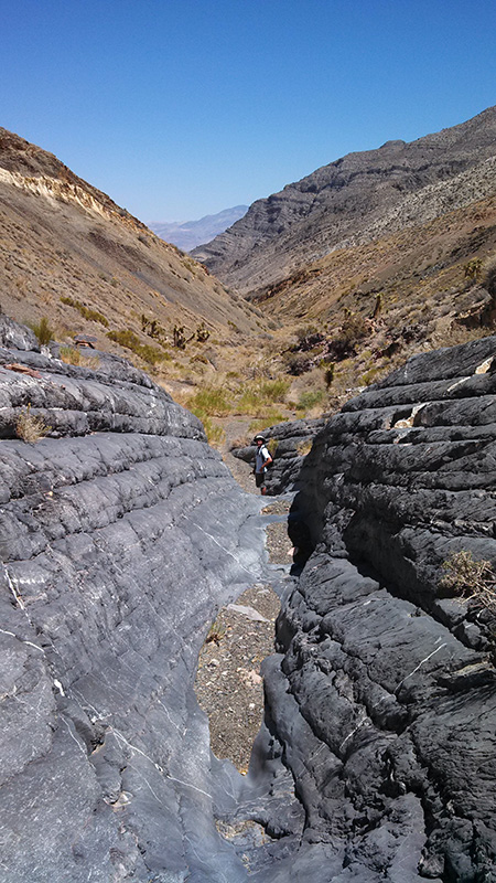
It was now 1pm, three hours in. Given that the return hike would be uphill, it could very well take longer, so Bobby, Danny and Joey decided to turn around. Greg, Bob and Morrie pushed on a bit further, just to see if we could make it to the “1st narrows” that Digonnet indicates in his book, ½ mile further.
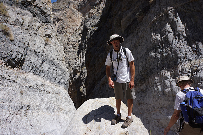
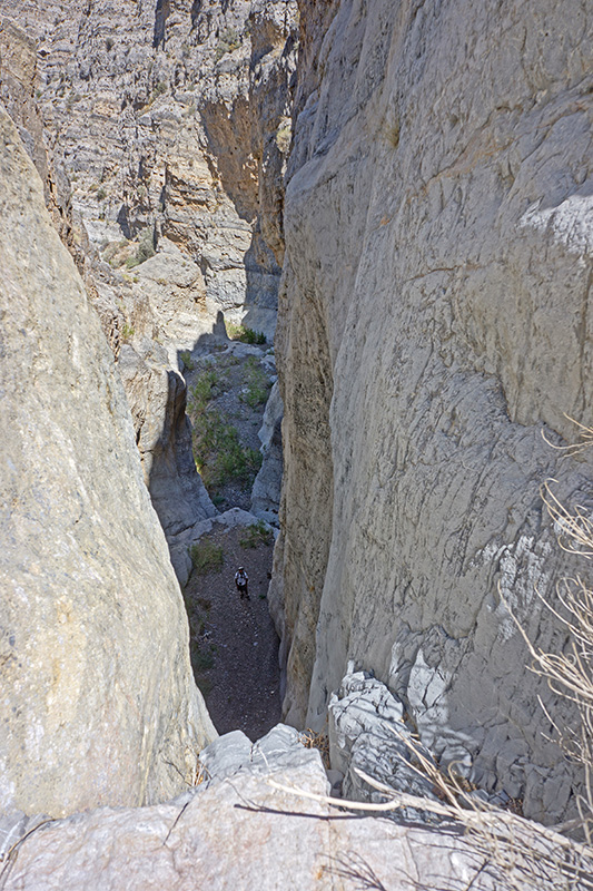
  We reached those narrows very soon, and in another 1500' came to the top of an unclimbable 60' fall. Digonnet said there was a way around, but I decided this was far enough for me, given the time and the fact that the return was all uphill. Greg wanted to push on, and Bob was willing to go with him, so I suggested I stay up here to take a picture of them when they got to the bottom. The reached the bottom in 10 minutes. Unfortunately the lighting was so poor, the scene of them was not very photogenic, with half in the blazing sun and half in the dark canyon. Greg’s picture of me taken from below came out much nicer. We reached those narrows very soon, and in another 1500' came to the top of an unclimbable 60' fall. Digonnet said there was a way around, but I decided this was far enough for me, given the time and the fact that the return was all uphill. Greg wanted to push on, and Bob was willing to go with him, so I suggested I stay up here to take a picture of them when they got to the bottom. The reached the bottom in 10 minutes. Unfortunately the lighting was so poor, the scene of them was not very photogenic, with half in the blazing sun and half in the dark canyon. Greg’s picture of me taken from below came out much nicer.
After 25 minutes here, 1:45pm, Greg and Bob came back and we started our return hike. The ascent back up the canyon was so gradual, it 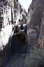 did not feel like climbing up a mountain as I feared, and our progress was no slower than it was descending. At the chockstone, Greg was able to climb straight up, but only by doing the splits with his long legs, while Bob and I labored on the bypass climb. Given we made no stops, we were back at camp at 5:15pm, in only 2½ hours, where the three others were well into relaxation mode. did not feel like climbing up a mountain as I feared, and our progress was no slower than it was descending. At the chockstone, Greg was able to climb straight up, but only by doing the splits with his long legs, while Bob and I labored on the bypass climb. Given we made no stops, we were back at camp at 5:15pm, in only 2½ hours, where the three others were well into relaxation mode.
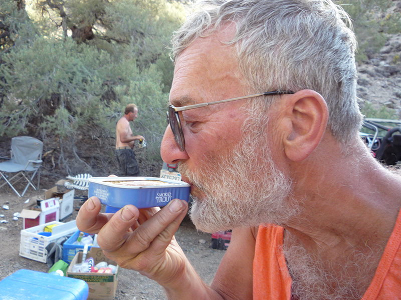
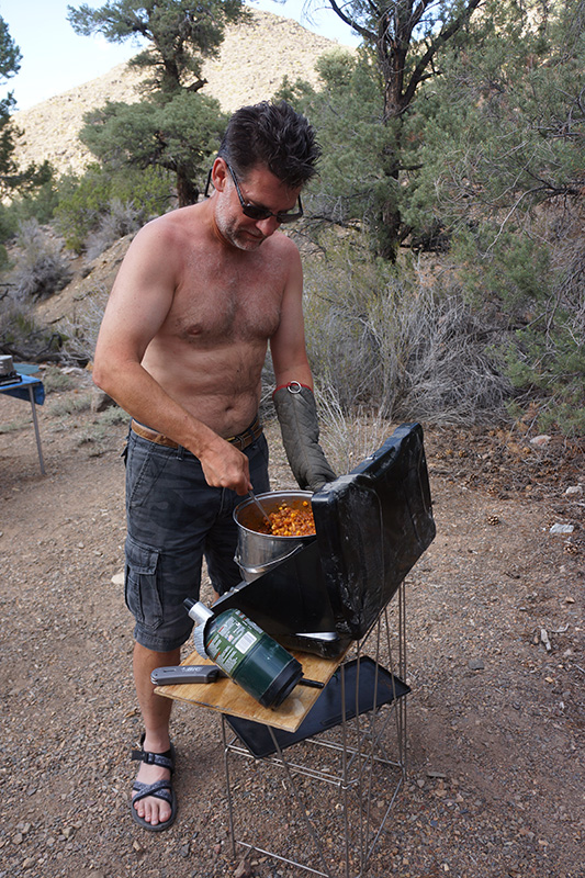
For an evening appetizer we had smoked trout, drinking every last drop of liquid in the can. The menu said tonight was pasta, but since we had 2 hamburgers left from the 2nd night that risked going bad, we decided to have chile and beef instead. I have no record of what we did for a night hike, but I think we walked back up the road a bit to where it skirted around the head of a branch of our little canyon. 
|


