|
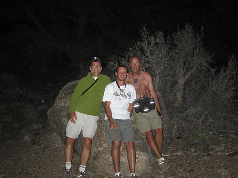
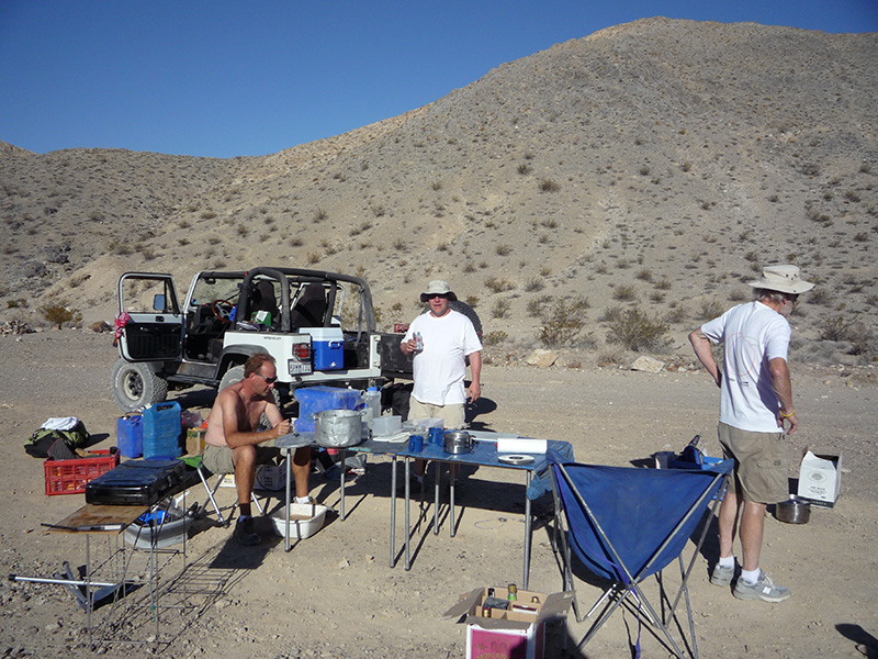
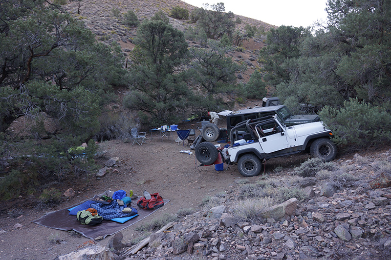
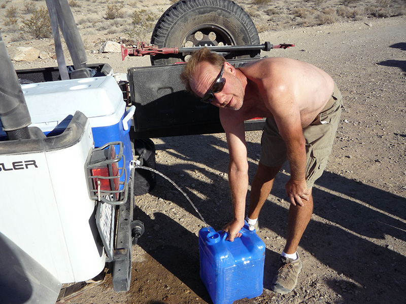
T his morning it was 56°, only a little warmer than yesterday despite the low elevation, and (surprise!) clear again. We hadn’t seen even a tiny cloud in 5 days. We used a whole loaf of bread to make french toast, 3 slices per person. Since it was half way through the trip, we did some housekeeping like draining water from the coolers to use as future dishwater. Despite the cool start, I suspected it would rapidly heat up, so we were in kind of a hurry to pack up. We managed to be ready to go by 9:15am. his morning it was 56°, only a little warmer than yesterday despite the low elevation, and (surprise!) clear again. We hadn’t seen even a tiny cloud in 5 days. We used a whole loaf of bread to make french toast, 3 slices per person. Since it was half way through the trip, we did some housekeeping like draining water from the coolers to use as future dishwater. Despite the cool start, I suspected it would rapidly heat up, so we were in kind of a hurry to pack up. We managed to be ready to go by 9:15am.
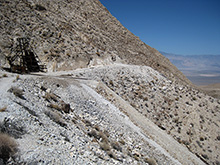
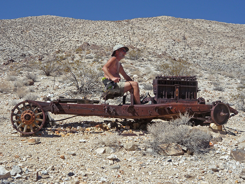
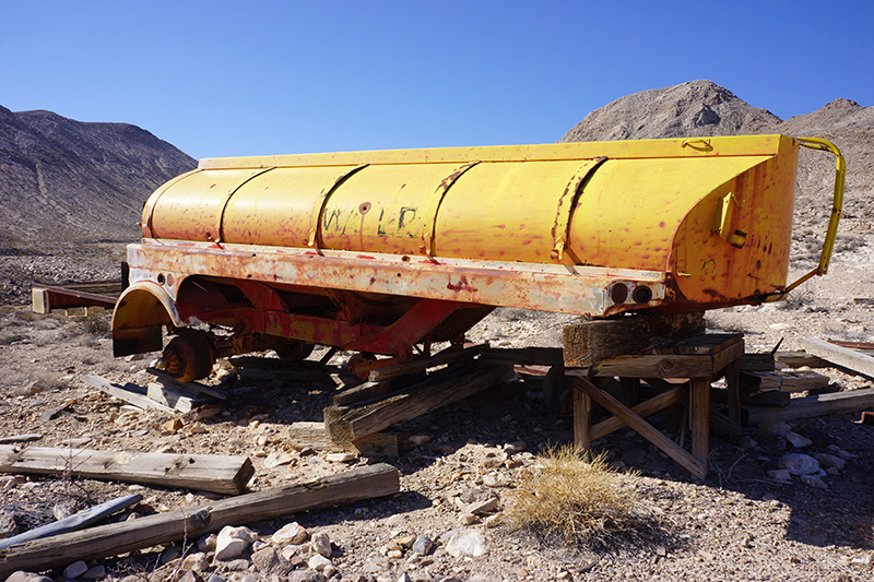
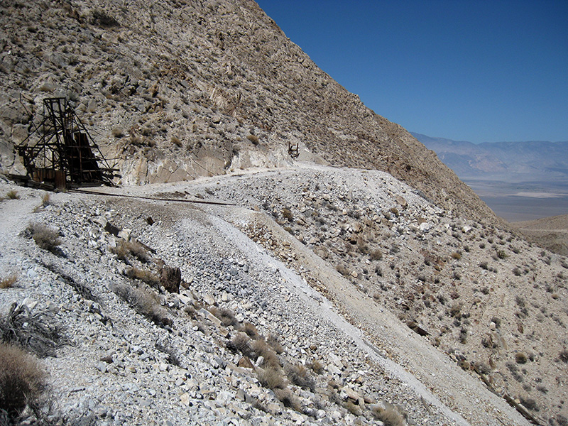
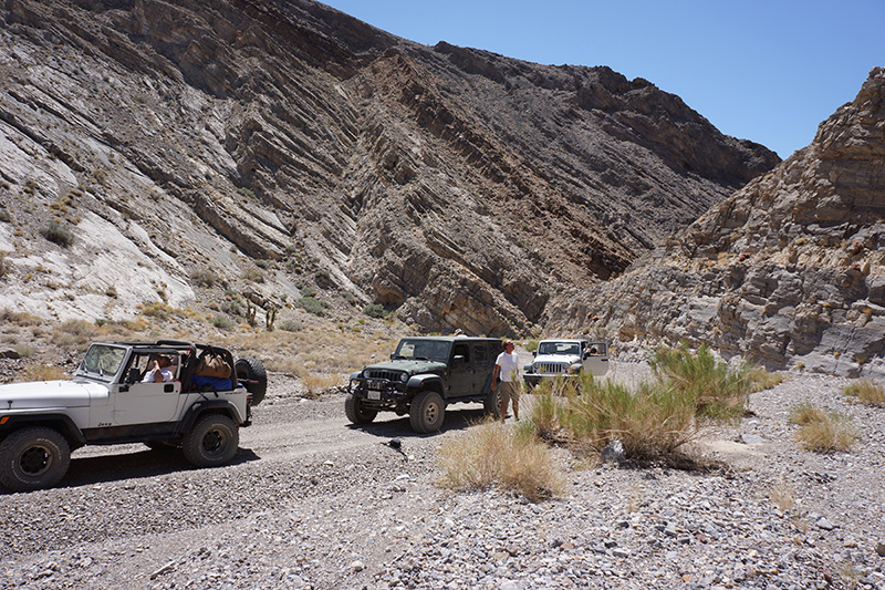
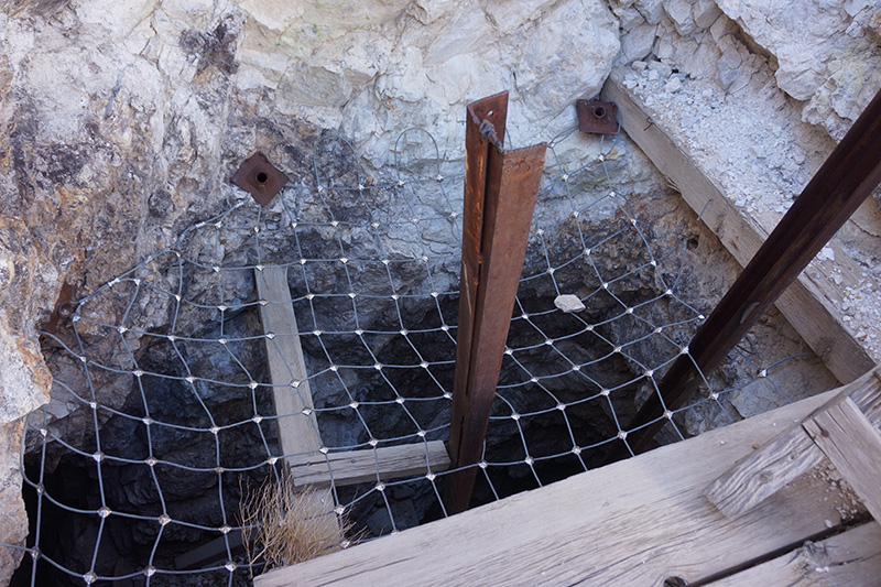
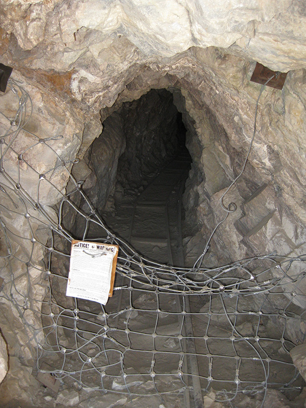
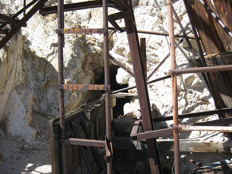
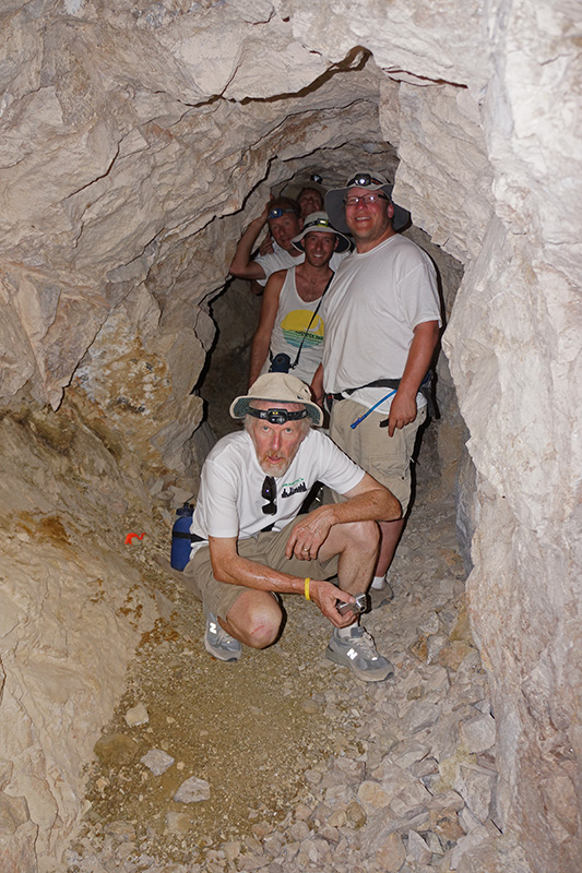
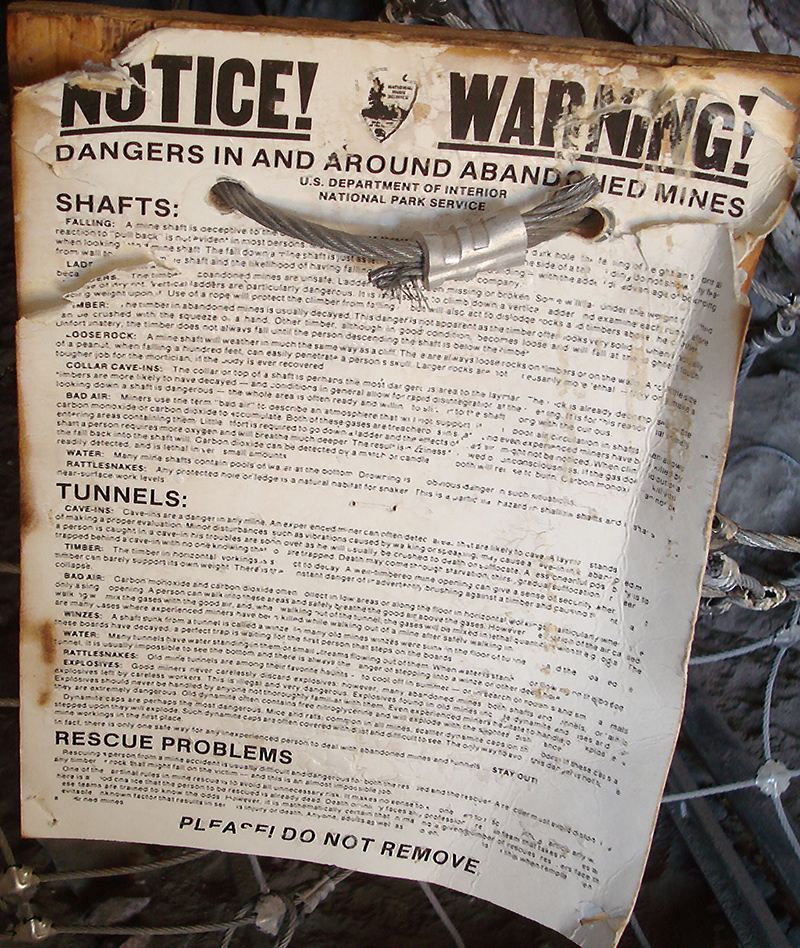
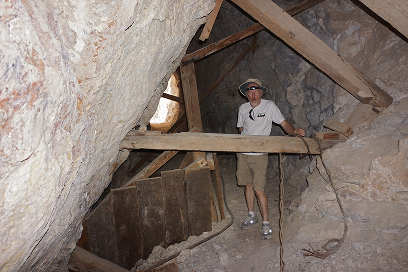
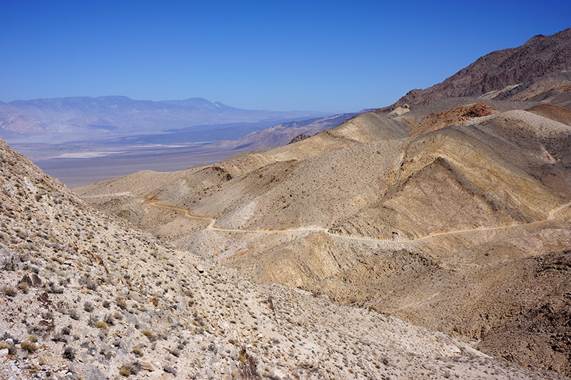
For our first adventure, I suggested we visit the Lippincott Mine, a fraction of a mile further down the road (where the Racetrack Road really ends). Compared to many, this mine was an unusually large operation with 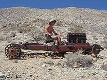 multiple shafts and tunnels (most of multiple shafts and tunnels (most of 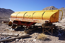 them covered with impenetrable wire mesh), large structures, and sections of several trucks, including a large yellow tanker that looked like it was used for water, and a naked chassis that Bobby thought was a Buick. Not all the mine openings were blocked, so we walked into one to its end in 50', and Joey walked into another that he said went for 150-200'. This, despite dire warnings in very small type posted at the openings. them covered with impenetrable wire mesh), large structures, and sections of several trucks, including a large yellow tanker that looked like it was used for water, and a naked chassis that Bobby thought was a Buick. Not all the mine openings were blocked, so we walked into one to its end in 50', and Joey walked into another that he said went for 150-200'. This, despite dire warnings in very small type posted at the openings.
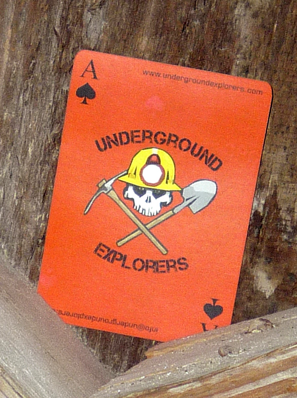
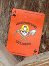  Inside one of the entrances a group called Underground Explorers left their signature ace-of-spades playing cards. We saw these cards at a few other mines in the area, too. There was one very poor road that traversed high up on a slope, which we chose to walk rather than drive, which led to yet another tunnel. That road went around the corner of a hill to a point where we could see the Lippincott Road and Saline Valley. There was so much here, we spent over 2 hours, somewhat defeating the goal of leaving this low altitude in a hurry. Inside one of the entrances a group called Underground Explorers left their signature ace-of-spades playing cards. We saw these cards at a few other mines in the area, too. There was one very poor road that traversed high up on a slope, which we chose to walk rather than drive, which led to yet another tunnel. That road went around the corner of a hill to a point where we could see the Lippincott Road and Saline Valley. There was so much here, we spent over 2 hours, somewhat defeating the goal of leaving this low altitude in a hurry.
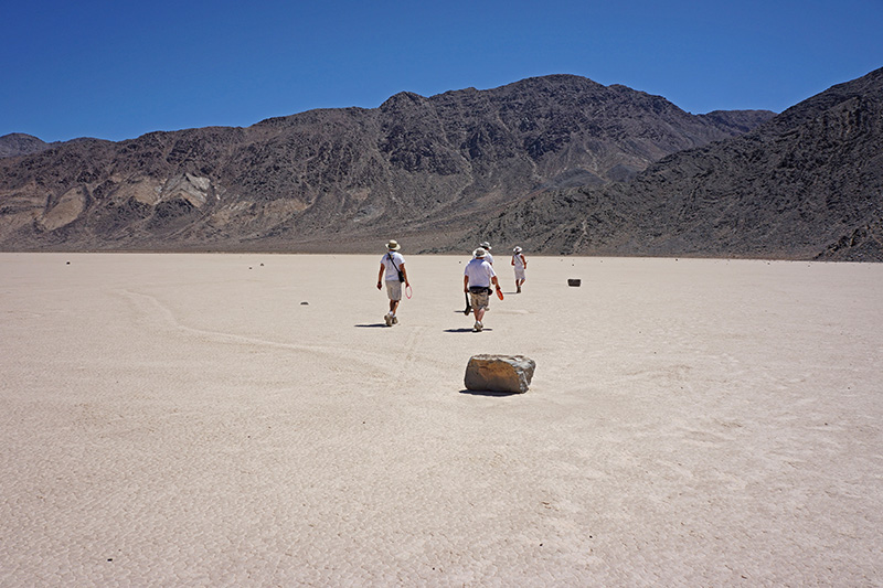
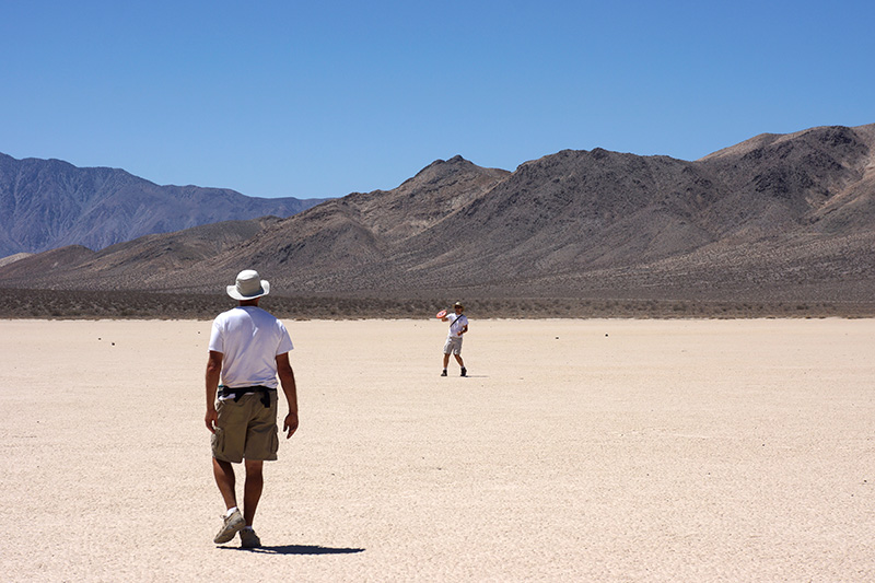
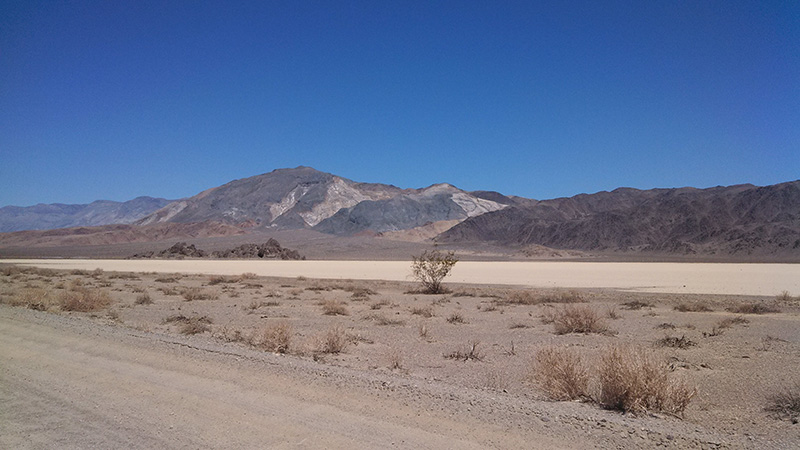
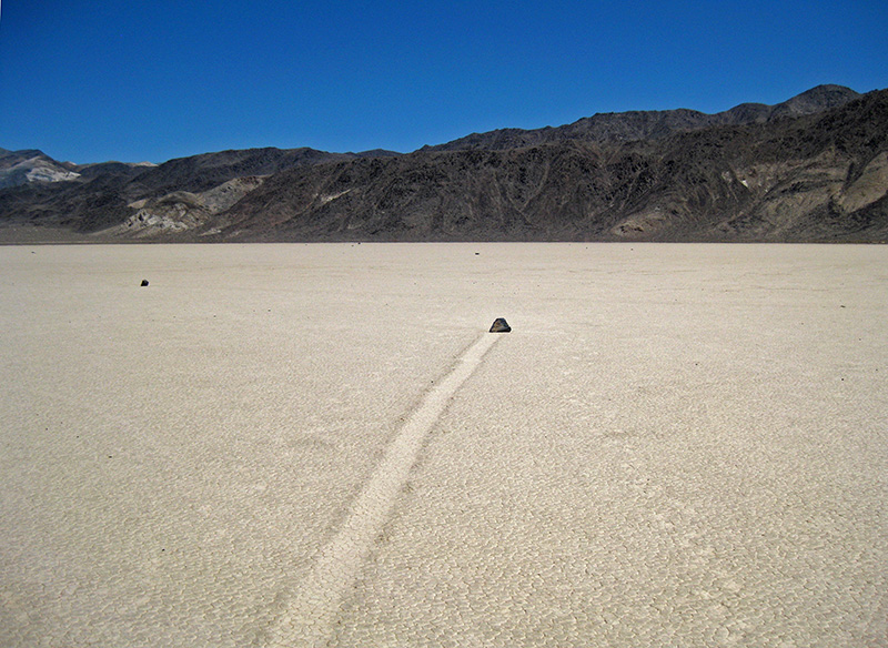
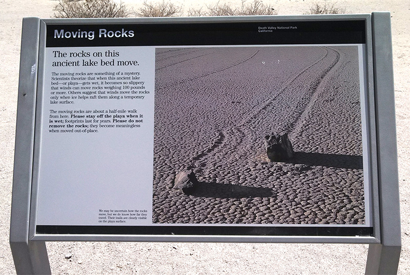
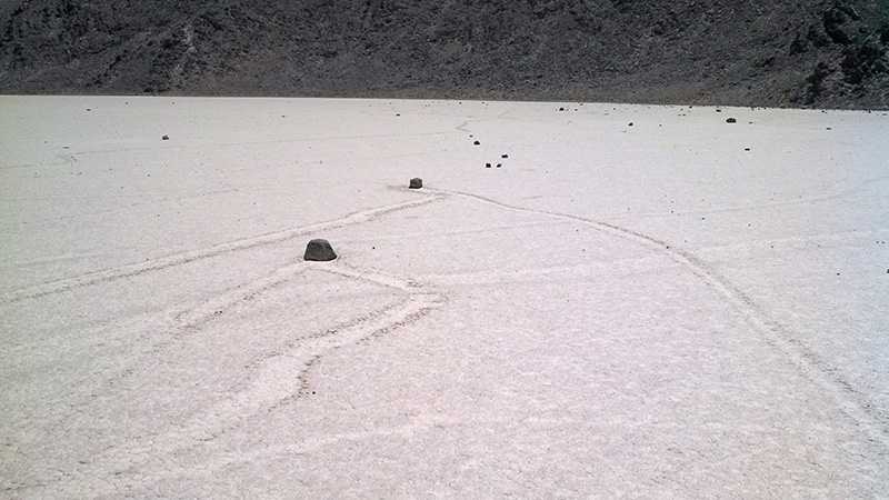
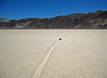 Next on the agenda was a visit to the world-famous Moving Rocks, a half-mile walk out on the southern end of the Racetrack playa (same place we went for Frisbee last night). There’s a little parking area here and a modern information sign. During our walk, we saw a car (I think a Mustang) pull into the lot, and a couple got out for a similar walk. I’m always worried that the Moving Rocks will be moved or stolen. While some are over 100 pounds, many Next on the agenda was a visit to the world-famous Moving Rocks, a half-mile walk out on the southern end of the Racetrack playa (same place we went for Frisbee last night). There’s a little parking area here and a modern information sign. During our walk, we saw a car (I think a Mustang) pull into the lot, and a couple got out for a similar walk. I’m always worried that the Moving Rocks will be moved or stolen. While some are over 100 pounds, many 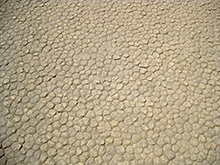 are light enough to carry or roll. But I was glad to see that there were plenty in their natural locations, at the end of straight or long arching paths gouged in the playa. At the time of this trip scientists still didn’t know for sure how those rocks moved. It was not until 2014, using 24-hour cameras and GPSes, that they proved one of the leading theories, which was also printed on the sign: rocks get embedded in large sheets of ice that slide on the surface on windy days, when the playa is wet and the temperature is cold enough. are light enough to carry or roll. But I was glad to see that there were plenty in their natural locations, at the end of straight or long arching paths gouged in the playa. At the time of this trip scientists still didn’t know for sure how those rocks moved. It was not until 2014, using 24-hour cameras and GPSes, that they proved one of the leading theories, which was also printed on the sign: rocks get embedded in large sheets of ice that slide on the surface on windy days, when the playa is wet and the temperature is cold enough.
In addition to viewing the rocks, we did what the playa is best for: Frisbee and Aerobie. For Aerobie, the six of us spread out into a hexagon maybe 150-200' on a side—the limit of the Aerobie’s range. The person at the opposite corner seemed so incredibly far away, it was hard to imagine we were playing the same game. The entire stop in this Walking Rocks area took an hour and 20 minutes, and we were back driving at 1pm.
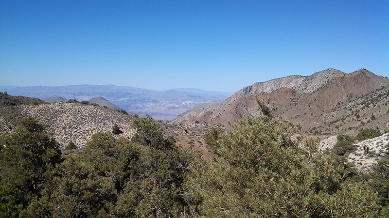
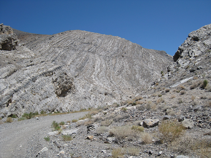
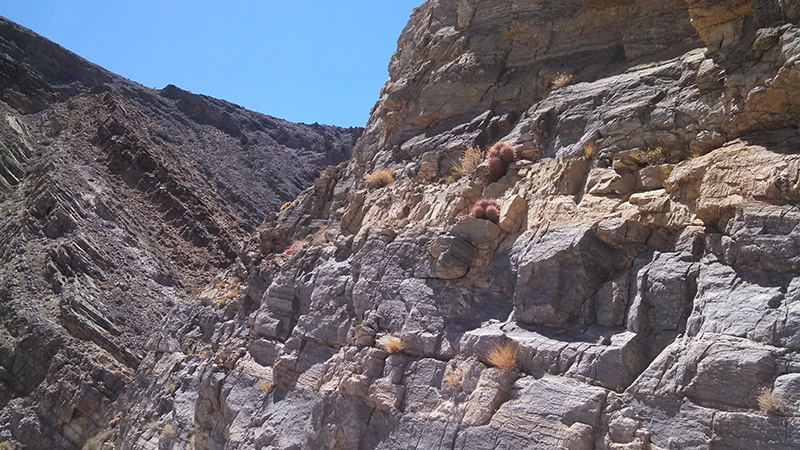
  Now we had a bit over 20 miles left to drive today, all on dirt or 4WD. The 8-miles back to Teakettle Junction on the severe washboard took a half hour. We then turned right on the Hunter Mountain road and within 5 minutes got to Lost Burro Gap. This is where the road goes in an opening in an arm of the Cottonwood Mountains east of the Racetrack, which separates Racetrack Valley from Hidden Valley. We stopped to get out and admire the unusual diagonal bedding planes in this area as well as compass cactuses up on the walls of the gap. I didn't know till writing this that this area is full of fossils—something to look for next time. Also here is a short side road to Lost Burro Mine, but we saved that for another day. Now we had a bit over 20 miles left to drive today, all on dirt or 4WD. The 8-miles back to Teakettle Junction on the severe washboard took a half hour. We then turned right on the Hunter Mountain road and within 5 minutes got to Lost Burro Gap. This is where the road goes in an opening in an arm of the Cottonwood Mountains east of the Racetrack, which separates Racetrack Valley from Hidden Valley. We stopped to get out and admire the unusual diagonal bedding planes in this area as well as compass cactuses up on the walls of the gap. I didn't know till writing this that this area is full of fossils—something to look for next time. Also here is a short side road to Lost Burro Mine, but we saved that for another day.
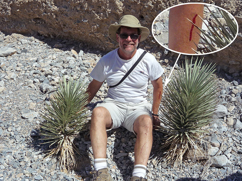
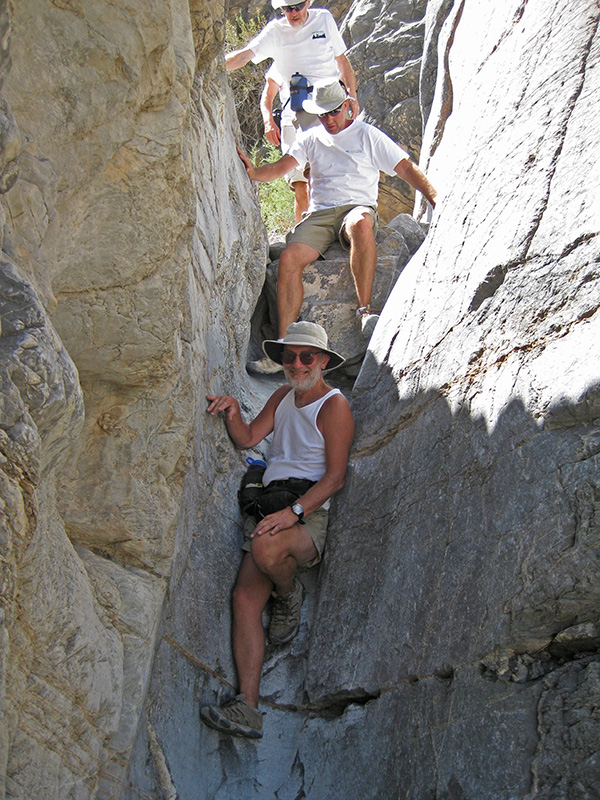
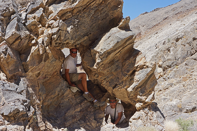
 Near the gap we saw an interesting little slot canyon bearing south, so we took a short walk. We found a very cute chute off to the side that we could climb into, and a small rock outcropping with a double window. Bobby posed for a picture between two baby Joshua trees, not realizing that one of them was poking a hole in his arm, bleeding profusely. During the 35 minutes we spent at Lost Burro Gap. the same couple in a Mustang came by, that we saw earlier at the Racetrack. They were clearly driving toward Hunter Mountain, which I thought was risky in a street-grade vehicle. But if it’s dry, maybe it would be fine for them. Near the gap we saw an interesting little slot canyon bearing south, so we took a short walk. We found a very cute chute off to the side that we could climb into, and a small rock outcropping with a double window. Bobby posed for a picture between two baby Joshua trees, not realizing that one of them was poking a hole in his arm, bleeding profusely. During the 35 minutes we spent at Lost Burro Gap. the same couple in a Mustang came by, that we saw earlier at the Racetrack. They were clearly driving toward Hunter Mountain, which I thought was risky in a street-grade vehicle. But if it’s dry, maybe it would be fine for them.
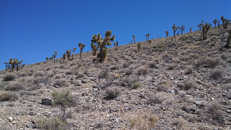
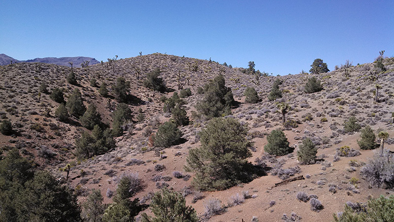
We reached the turnoff to White Top Mountain Road, 1½ miles further, at 2:30pm. We had “just” 10 more miles to go, but the Tom Harrison map indicated the last half was 4WD-only. 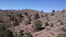 If it’s anything like the last 5 miles of the Phinney Canyon Road, that alone could take an hour. Still, I thought this allowed plenty of time for sightseeing and exploration on the way. Starting at 4840', the first several miles were pretty smooth, climbing steadily through beautiful Joshua tree country. Around 6500' pinyon pines were added to the mix, which seemed a bit incongruous, but this combination continued the rest of the way up. If it’s anything like the last 5 miles of the Phinney Canyon Road, that alone could take an hour. Still, I thought this allowed plenty of time for sightseeing and exploration on the way. Starting at 4840', the first several miles were pretty smooth, climbing steadily through beautiful Joshua tree country. Around 6500' pinyon pines were added to the mix, which seemed a bit incongruous, but this combination continued the rest of the way up.
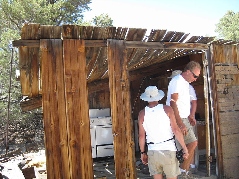
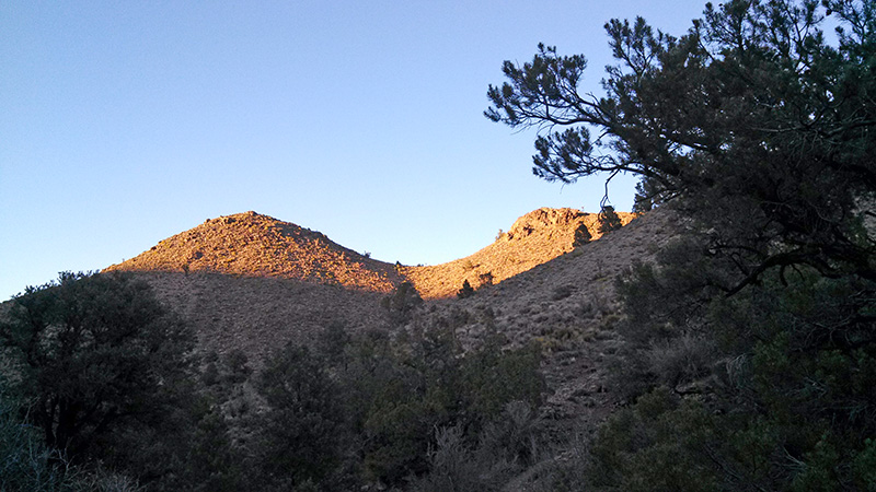
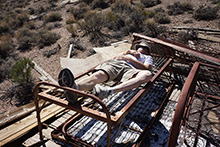 At the 9.5 mile mark we came to the ruins of a ranch, and stopped for 10 minutes examining the somewhat dangerous living quarters, with Bobby trying out the skeleton of an old cot. The White Top Road didn’t get very slow until a half mile before the end, where it started going back down hill after a high point at 7000'. The drop wasn’t much, ending at 6640' near the head of a canyon, by a prospect and some tailings. As usual, the end of the road meant a fine campsite, so we decided to settle here for the remaining 3 nights of our trip. We got here at 3:50pm, an hour earlier than any of the other nights. At the 9.5 mile mark we came to the ruins of a ranch, and stopped for 10 minutes examining the somewhat dangerous living quarters, with Bobby trying out the skeleton of an old cot. The White Top Road didn’t get very slow until a half mile before the end, where it started going back down hill after a high point at 7000'. The drop wasn’t much, ending at 6640' near the head of a canyon, by a prospect and some tailings. As usual, the end of the road meant a fine campsite, so we decided to settle here for the remaining 3 nights of our trip. We got here at 3:50pm, an hour earlier than any of the other nights.
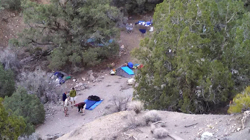
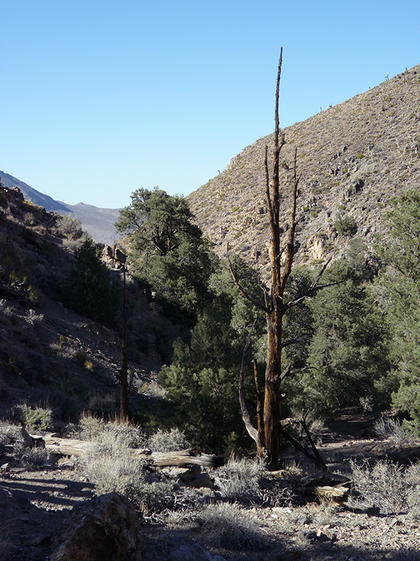
 In contrast to our first two campsites, this one was fairly enclosed, with steep canyon walls on two sides and trees blocking most of the view up and down the canyon. But it was a cozy spot, right at the start of what I expected would be a great day hike down the canyon to the huge Bighorn Gorge tomorrow. The little canyon we were in is one of numerous upper branches of the gorge. None have names on any map, but Digonnet uses the name O’Brien Canyon for the one that our little canyon joins in ½ mile, so I’m calling this spot O’Brien Camp. In contrast to our first two campsites, this one was fairly enclosed, with steep canyon walls on two sides and trees blocking most of the view up and down the canyon. But it was a cozy spot, right at the start of what I expected would be a great day hike down the canyon to the huge Bighorn Gorge tomorrow. The little canyon we were in is one of numerous upper branches of the gorge. None have names on any map, but Digonnet uses the name O’Brien Canyon for the one that our little canyon joins in ½ mile, so I’m calling this spot O’Brien Camp.
We each found good sleeping spots, either near the main campsite or down the canyon a small bit. However we realized very soon that the sand at some of these spots is the type that ants usually like, so we went looking for ant hills. We found just one, which we sprayed profusely with Raid. We then set up our sleeping areas, but when I went back to mine a minute later, there were ants all over my pad. Other people checked and some had ants, too. So, escalating the battle, we sprayed a Raid border all around our ground cloths, and then killed the ants that were already inside. This usually works well and it did here, too: the barrier lasted 3 nights without refreshing.
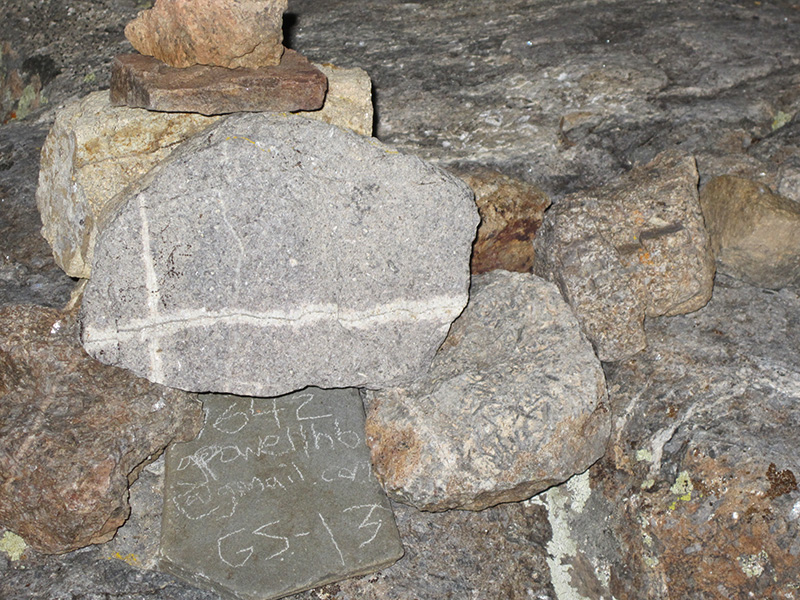
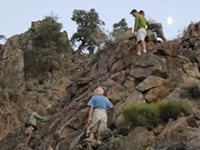 We had a tuna and salad dinner with leftover buns for bread; always a wonderful meal, and it requires no cooking. That evening, starting around 7:30pm, some of us hiked straight up the slope next to the camp to get a vertical view of our site, and then we all hiked a very short distance down our canyon and then clamored 50' up the side. Here Greg incriminated himself by scratching his email address and “GS-13” on rock by a cairn we built. The whole journey was only 45 minutes. We had a tuna and salad dinner with leftover buns for bread; always a wonderful meal, and it requires no cooking. That evening, starting around 7:30pm, some of us hiked straight up the slope next to the camp to get a vertical view of our site, and then we all hiked a very short distance down our canyon and then clamored 50' up the side. Here Greg incriminated himself by scratching his email address and “GS-13” on rock by a cairn we built. The whole journey was only 45 minutes. 
|

