|
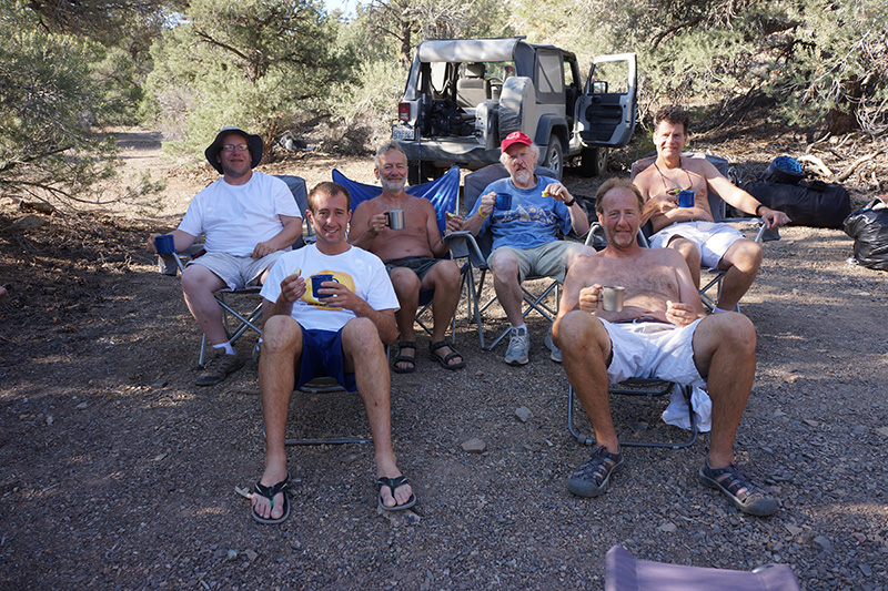
T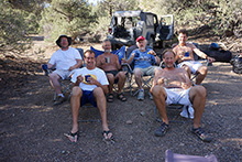 he warning trend continued, with a blistering 62° at dawn. We had pancakes for our final breakfast, and after a final eye opener and the dangerous job of emptying the gas cans, we were packed up amd ready to leave at 9:45am. Today we faced a long drive: 31 miles on dirt roads of varying condition, 16 miles on graded dirt road, and 261 miles of highway he warning trend continued, with a blistering 62° at dawn. We had pancakes for our final breakfast, and after a final eye opener and the dangerous job of emptying the gas cans, we were packed up amd ready to leave at 9:45am. Today we faced a long drive: 31 miles on dirt roads of varying condition, 16 miles on graded dirt road, and 261 miles of highway 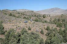 back to Huntington Beach. But this didn’t mean we couldn’t have some fun on the way. back to Huntington Beach. But this didn’t mean we couldn’t have some fun on the way.
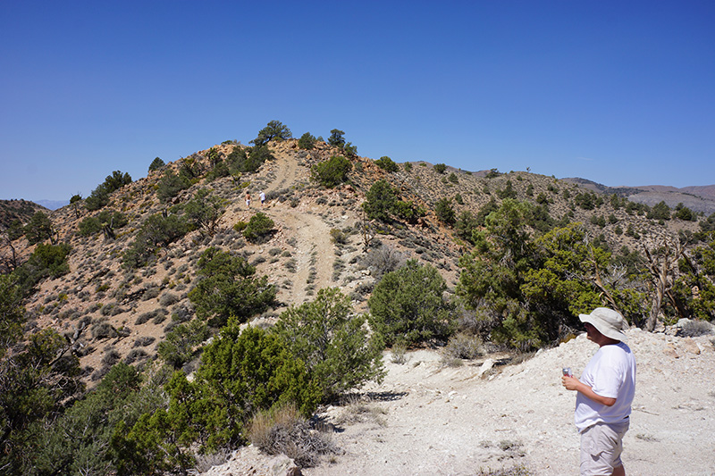
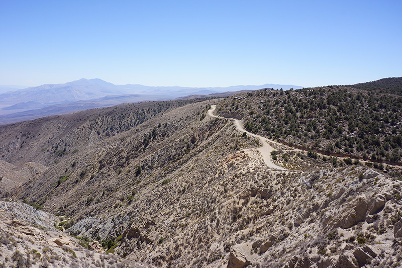
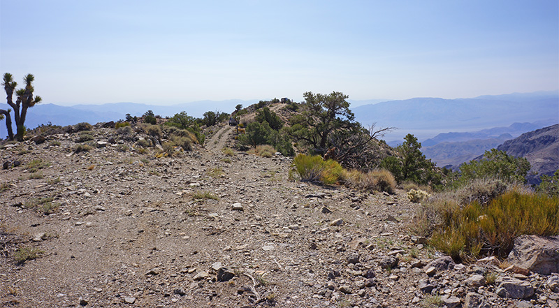
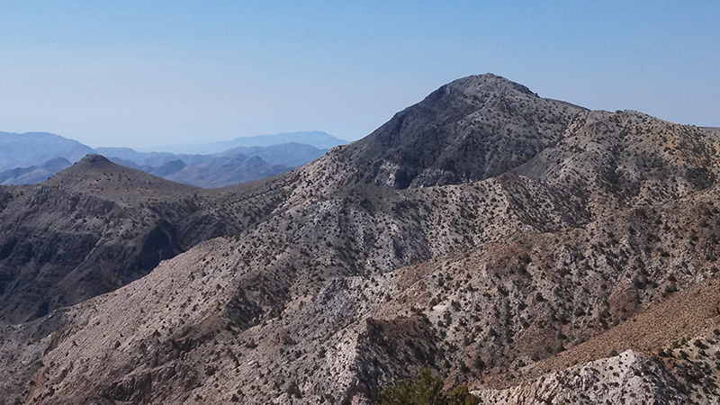
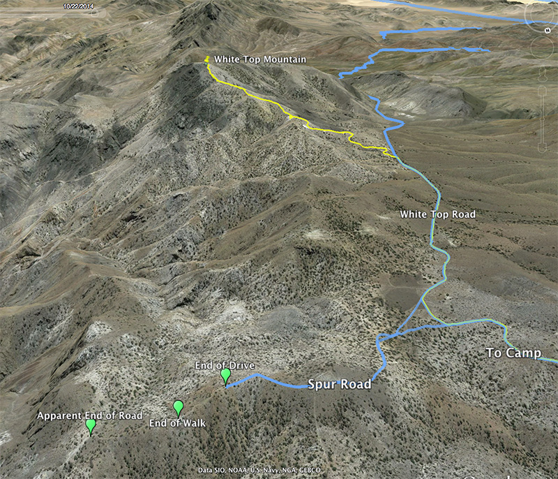
One of our maps showed that the White Top Mountain Road was not just a single spur, but it had another 0.3-mile spur branching off of it, 1.2 miles from our campsite, so we decided to explore it.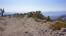 We got to there in 15 minutes, and were pleasantly surprised to find that this spur was rather harrowing. I’m calling this the White Top Spur Road. It took us up and up on the crest of a narrow, undulating ridge. We were higher than anything else in all directions, except for White Top Mountain to the south, We got to there in 15 minutes, and were pleasantly surprised to find that this spur was rather harrowing. I’m calling this the White Top Spur Road. It took us up and up on the crest of a narrow, undulating ridge. We were higher than anything else in all directions, except for White Top Mountain to the south, 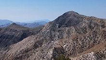 and every time we got to a rise, it looked like we were about to drive off a cliff. The road kept going like this, much further than the 0.3 miles on the map. In addition, there was at least one spur road to the left that we did not take. and every time we got to a rise, it looked like we were about to drive off a cliff. The road kept going like this, much further than the 0.3 miles on the map. In addition, there was at least one spur road to the left that we did not take.
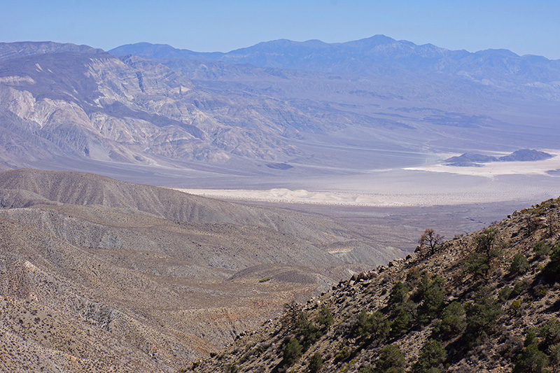
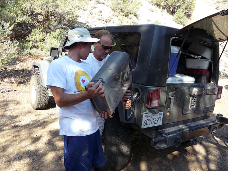
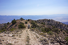 The spur road got to a high point and then descended gradually, but still we couldn’t see where it was headed, except toward Death Valley. Eventually at 0.4 miles we were too chicken to keep driving—not because of the road condition, but the fear that there would be no place to turn around. In any case walking was just as fast, so we grabbed a beer and proceeded on foot. A few minutes further down there was a rusty, solar-powered box, padlocked, with the initials TMO stenciled on it, but no other markings except for a very faded label, which I enhanced using Photoshop in hopes of deciphering it (but never succeeded). The spur road got to a high point and then descended gradually, but still we couldn’t see where it was headed, except toward Death Valley. Eventually at 0.4 miles we were too chicken to keep driving—not because of the road condition, but the fear that there would be no place to turn around. In any case walking was just as fast, so we grabbed a beer and proceeded on foot. A few minutes further down there was a rusty, solar-powered box, padlocked, with the initials TMO stenciled on it, but no other markings except for a very faded label, which I enhanced using Photoshop in hopes of deciphering it (but never succeeded).
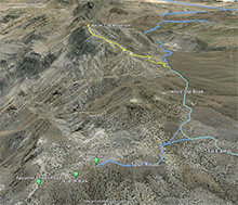 We didn’t walk all the way to the bitter end, as it looked it would keep going down indefinitely, maybe in fact to Death Valley. But later I looked on Google Earth and saw that the road ended in another ¼ mile. But it also looked like it would be possible to continue hiking for another 9 miles, all the way to the valley floor, 6000' below, ending at Scotty’s Castle Road. That would be quite a hike—and hot! We spent nearly an hour on this little walk. Back at the jeeps we had another beer and drove off. We were down to the bottom of the White Top Spur Road at 11:20am. We didn’t walk all the way to the bitter end, as it looked it would keep going down indefinitely, maybe in fact to Death Valley. But later I looked on Google Earth and saw that the road ended in another ¼ mile. But it also looked like it would be possible to continue hiking for another 9 miles, all the way to the valley floor, 6000' below, ending at Scotty’s Castle Road. That would be quite a hike—and hot! We spent nearly an hour on this little walk. Back at the jeeps we had another beer and drove off. We were down to the bottom of the White Top Spur Road at 11:20am.
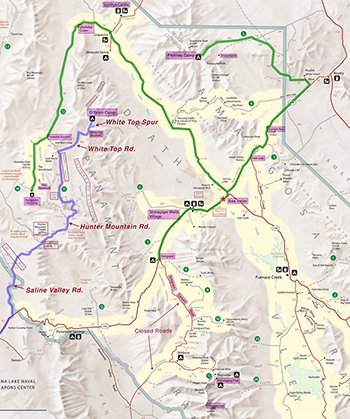 It took another 50 minutes to drive back down the White Top Mountain Road to the Hunter Mountain Road. This was probably the last of our 4WD driving. The ride from here through Hidden Valley and Ulida Flat to Hunter Mountain is usually pretty fast, but it’s one of my favorite drives in Death Valley. I had long wanted to spend more time here and explore the numerous side roads, but we didn’t have time to do any more today. (This was to be a main focus of Greenshit ’14.) We drove mostly nonstop for the next hour (19 miles) to the top of Hunter Mountain. Hunter Mountain is kind of strange, because it doesn’t feel like a mountain when you’re on it. Its “summit”, if you can call it that, is more like a rolling plateau several miles across, whose high points are no more than 100' above the low points, and the road goes right over this plateau. The true summit appears to be a point called Jackass at 7455', not much above the 7180' level of our road. It’s also strange that, rather than being an obstacle as most mountains are, the top of Hunter Mountain is actually the easiest route between points on either side. In fact there is a major 3-way intersection right beneath the highest point of the road, called South Pass, where you can go to Saline Valley, Ulida Flat, or out to the highway. It took another 50 minutes to drive back down the White Top Mountain Road to the Hunter Mountain Road. This was probably the last of our 4WD driving. The ride from here through Hidden Valley and Ulida Flat to Hunter Mountain is usually pretty fast, but it’s one of my favorite drives in Death Valley. I had long wanted to spend more time here and explore the numerous side roads, but we didn’t have time to do any more today. (This was to be a main focus of Greenshit ’14.) We drove mostly nonstop for the next hour (19 miles) to the top of Hunter Mountain. Hunter Mountain is kind of strange, because it doesn’t feel like a mountain when you’re on it. Its “summit”, if you can call it that, is more like a rolling plateau several miles across, whose high points are no more than 100' above the low points, and the road goes right over this plateau. The true summit appears to be a point called Jackass at 7455', not much above the 7180' level of our road. It’s also strange that, rather than being an obstacle as most mountains are, the top of Hunter Mountain is actually the easiest route between points on either side. In fact there is a major 3-way intersection right beneath the highest point of the road, called South Pass, where you can go to Saline Valley, Ulida Flat, or out to the highway.
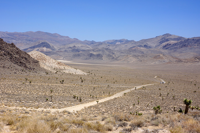
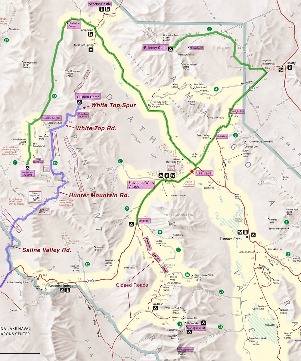
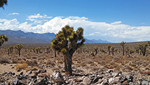 We just started our descent from the high point of the road when we saw a wet gully or creek on the right. We got out to examine a large tank apparently erected to hold water for cattle, and still in use. From the map, this is either Jackass Spring or an unnamed spring downhill of it. This was a half hour stop. Continuing our gradual descent off Hunter Mountain, we popped into an alluvial fan heading down to Lee Flat. This area has one of the densest Joshua tree forests in the Death Valley area. We just started our descent from the high point of the road when we saw a wet gully or creek on the right. We got out to examine a large tank apparently erected to hold water for cattle, and still in use. From the map, this is either Jackass Spring or an unnamed spring downhill of it. This was a half hour stop. Continuing our gradual descent off Hunter Mountain, we popped into an alluvial fan heading down to Lee Flat. This area has one of the densest Joshua tree forests in the Death Valley area.
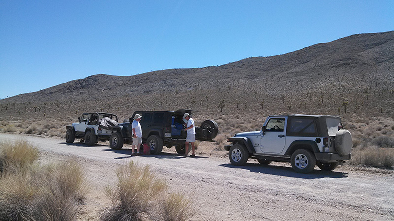
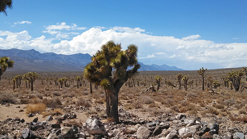
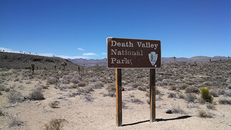
Ten miles from the top of Hunter Mountain, at 2:45pm, we reached the border of Death Valley National Park. It was only a few more miles to the highway, so we stopped to reattach my sway bar and have our last beer. At 3:25pm we were on the highway, CA 190, heading toward Olancha, 27 miles west. We didn’t drive too fast because our tires were still aired down, and Olancha is the nearest gas station. In Olancha we spent 45 minutes fueling up and pumping up our tires from one of those poky coin-operated air machines. We didn’t actually have to pay for air because California has a law that paying customers get free air.
We began the long drive south on U.S. 395 at 4:45pm. One thing I don’t like about leaving Death Valley via Olancha is that there’s no decent place to eat without going 20 minutes out of our way into Ridgecrest, 45 miles from Olancha. And even in Ridgecrest we have never found a great place. But we tried once again, and went to a little Mexican sandwich shop, La Fiesta Sandwiches & Things, right in the center of town. It looked like a hole in the wall but the food was surprisingly good, and they sold bottled beer. The diversion through Ridgecrest plus dinner took 1½ hours.
The rest of the drive, 170 miles, took 3 hours, with the only stop being gas. The total drive from O’Brien Camp was 310 miles. We arrived at Joey's house at exactly 10pm, just enough time for a drink and jacuzzi. We didn’t attempt any unpacking that night. 
|

